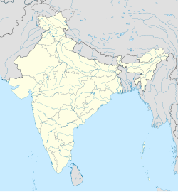
Thiruninravur
This article has multiple issues. Please help improve it or discuss these issues on the talk page. (Learn how and when to remove these messages)
(Learn how and when to remove this message)
|
Thiruninravur, Chennai | |
|---|---|
Suburb | |
 | |
| Coordinates: 13°07′25″N 80°01′40″E / 13.1236°N 80.0279°E / 13.1236; 80.0279 | |
| Country | |
| State | Tamil Nadu |
| Metro | Chennai |
| Government | |
| • Type | Municipality |
| Area | |
• Total | 11 km2 (4 sq mi) |
| Population (2011)[1] | |
• Total | 37,095 |
| • Density | 3,400/km2 (8,700/sq mi) |
| Languages | |
| • Official | Tamil |
| Time zone | UTC+5:30 (IST) |
| Vehicle registration | TN 12 (RTO, Poonamallee) |
Thirunindravur is a locality in the western part of Chennai, Tamil Nadu. It lies within the Chennai Metropolitan Area, around 30 kilometers from the city center at Parry's Corner. The neighbourhood is served by Thirunindravur railway station of Chennai suburban railway. Thiruninravur lake provides the neighbourhood with water. It serves as the connecting hub between Chennai and Tirupati.
Demographics
[edit]As of 2011[update] India census, Thiruninravur had a population of 37095. Males constitute 50% of the population and females 50%. Thirunindravur has an average literacy rate of 91%, higher than the national average of 74%: male literacy is 95%, and female literacy is 88.6%.
Place of worship
[edit]Sri Bhaktavatsala Perumal is a prominent Hindu temple located in Thiruninravur, a suburban area of Chennai, Tamil Nadu. The temple is dedicated to Lord Vishnu and is an important religious and cultural site for devotees, particularly in the western part of Chennai.
Railway
[edit]Thiruninravur has a railway station on the Chennai Suburban Railway Network, making it well-connected to Chennai City. The Chennai Central-Arakkonam railway line passes through Thiruninravur.
Roadways
[edit]The Outer Ring Road which is being laid in order to connect Vandalur to Ennore is being routed via Thiruninravur (Nemilichery) and more other places. The National Highway - NH205 passes through Thiruninravur and also referred to as MTH road or CTH road. The phase I from Vandalur to Nemelicherry (Thirunindravur) has been completed and is available for traffic.
The Tamil Nadu Highways department issued a GO[2] on 4 October 2013 to extending the entire Chennai - Tiruttani highway to 6 lanes at a cost of 168 Cr. The first phase will involve extending the road to 4 lanes - 100 ft with center median and encroachments have already started to be removed.[3]
Education
[edit]Local colleges include Jaya Engineering College.
References
[edit]- ^ [1][dead link]
- ^ "Chennai to Tirupati 6-lane highway soon". Archived from the original on 23 October 2013. Retrieved 27 October 2013.
- ^ Staff Reporter (5 October 2013). "Encroachments along CTH Road removed". The Hindu. ISSN 0971-751X. Retrieved 29 January 2018.
External links
[edit]
| |||||||||||||||||||||||||||
| |||||||||||||||||||||||||||
| |||||||||||||||||||||||||||
| |||||||||||||||||||||||||||
| |||||||||||||||||||||||||||
| |||||||||||||||||||||||||||
| |||||||||||||||||||||||||||
| |||||||||||||||||||||||||||
| |||||||||||||||||||||||||||
| |||||||||||||||||||||||||||
Neighbourhoods of Chennai (city) | |
|---|---|
|
Areas of Chennai | |
|---|---|
| North |
|
| West |
|
| Central |
|
| South |
|
- Pages using gadget WikiMiniAtlas
- All articles with dead external links
- Articles with dead external links from January 2018
- Articles with short description
- Short description is different from Wikidata
- Use dmy dates from November 2018
- Use Indian English from November 2018
- All Wikipedia articles written in Indian English
- Articles needing additional references from December 2018
- All articles needing additional references
- Articles with multiple maintenance issues
- Coordinates on Wikidata
- Articles containing potentially dated statements from 2011
- All articles containing potentially dated statements
- Commons category link from Wikidata


