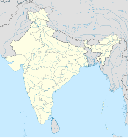
Kattankulathur
This article needs additional citations for verification. (February 2024) |
Kattankulathur | |
|---|---|
Town | |
| Coordinates: 12°48′29″N 80°01′44″E / 12.808°N 80.029°E | |
| Country | |
| State | Tamil Nadu |
| District | Chengalpattu |
| Taluk | Chengalpattu |
| Metro | Chennai Metropolitan Area |
| Languages | |
| • Official | Tamil |
| Time zone | UTC+5:30 (IST) |
| PIN | Chengalpattu-603203 |
| Telephone code | 044 |
| Vehicle registration | TN-19 |
| Nearest big city | Tambaram |
| Lok Sabha constituency | Chengalpattu |
| Vidhan Sabha constituency | Thiruporur |
Kattankulathur is a suburb of Chennai, India, located on the southern side of the city in Chengalpattu district of Tamil Nadu.[1] It comes under the Maraimalai Nagar municipality in the Chengalpattu taluk and within Chennai Metropolitan Area.
Transportation
[edit]Kattankulathur is located in the southern part of Chennai city. it is located along the busy GST Road on Chennai-Trichy National Highway. The neighborhood is served by the Kattankulathur railway station, which is about 20 minutes from Chennai Tambaram. The Chennai Suburban Railway operates a suburban railway service from Chennai Beach. It is well connected to other parts of the city by road. All MTC buses towards Maraimalai Nagar pass via Kattankulathur.
Education
[edit]SRM Institute of Science and Technology is located in Kattankulathur.
See also
[edit]See also
[edit]- Guduvancheri
- Potheri
- SRM Institute of Science and Technology
- Valliammai Engineering College
- Urapakkam
- Thailavaram
References
[edit]- ^ "Kattankulathur | Locality | GeoIQ". geoiq.io. Retrieved 1 February 2024.


