Água Santa, Rio Grande do Sul
Appearance
From Wikipedia, the free encyclopedia
This article is about the city in Rio Grande do Sul. For the football club, see Esporte Clube Água Santa. For the neighborhood in Rio de Janeiro, see Água Santa, Rio de Janeiro.
This article needs additional citations for verification. Please help improve this article by adding citations to reliable sources. Unsourced material may be challenged and removed. Find sources: "Água Santa, Rio Grande do Sul" – news · newspapers · books · scholar · JSTOR (January 2021) (Learn how and when to remove this message) |
Municipality in South, Brazil
Água Santa | |
|---|---|
 | |
| Coordinates: 28°10′S 52°2′W / 28.167°S 52.033°W / -28.167; -52.033 | |
| Country | |
| Region | South |
| State | |
| Founded | 1989 |
| Government | |
| • Mayor | Antônio Alfredo de Souza, PMDB |
| Area | |
• Total | 291.792 km2 (112.662 sq mi) |
| Elevation | 650 m (2,130 ft) |
| Population (2020 [1]) | |
• Total | 3,743 |
| • Density | 13.7/km2 (35/sq mi) |
| Time zone | UTC−3 (BRT) |
| Website | http://www.aguasantars.com.br/site/ |
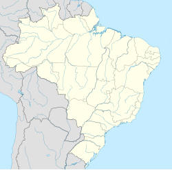
Água Santa (Portuguese: [ˈa.ɡwɐ ˈsɐ̃.tɐ] ⓘ, lit. 'holy water') is a municipality in the state of Rio Grande do Sul, Brazil.
See also
[edit]References
[edit]External links
[edit]- FAMURS General information about the town (in Portuguese).
 | This geographical article relating to Rio Grande do Sul is a stub. You can help Wikipedia by expanding it. |
Hidden categories:
- Pages using gadget WikiMiniAtlas
- Pages using the Phonos extension
- Articles needing additional references from January 2021
- All articles needing additional references
- Articles with short description
- Short description is different from Wikidata
- Coordinates on Wikidata
- Pages using infobox settlement with unknown parameters
- Pages with Portuguese IPA
- Pages including recorded pronunciations
- All stub articles


