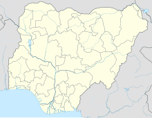
Yakubu Gowon Airport
Appearance
Yakubu Gowon Airport Jos Airport | |||||||||||
|---|---|---|---|---|---|---|---|---|---|---|---|
| Summary | |||||||||||
| Airport type | Public | ||||||||||
| Owner/Operator | Federal Airports Authority of Nigeria (FAAN) | ||||||||||
| Serves | Jos, Nigeria | ||||||||||
| Elevation AMSL | 4,229 ft / 1,289 m | ||||||||||
| Coordinates | 9°38′20″N 8°52′15″E / 9.63889°N 8.87083°E | ||||||||||
| Map | |||||||||||
 | |||||||||||
| Runways | |||||||||||
| |||||||||||
Yakubu Gowon Airport (IATA: JOS, ICAO: DNJO), also known as Jos Airport, is an airport serving Jos, the capital of the Plateau State of Nigeria. It was named after Yakubu Gowon, the Nigerian head of state from 1966 to 1975.
Airlines and destinations
[edit]| Airlines | Destinations |
|---|---|
| Arik Air | Lagos |
| Max Air | Abuja |
| ValueJet | Lagos |
See also
[edit]References
[edit]- ^ "Airport information for DNJO". World Aero Data. Archived from the original on 2019-03-05. Data current as of October 2006. Source: DAFIF.
- ^ Airport information for JOS at Great Circle Mapper.
External links
[edit]- Accident history for JOS at Aviation Safety Network
- SkyVector - Jos Airport
- OurAirports - Jos
- FAAN - Jos Facilities

