Wedderveer
Appearance
Wedderveer | |
|---|---|
 Windmill Spinnenkop Wedderveer in 2010 | |
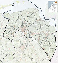
Location of Wedderveer in the province of Groningen | |
| Coordinates: 53°5′N 7°4′E / 53.083°N 7.067°E | |
| Country | Netherlands |
| Province | Groningen |
| Municipality | Westerwolde |
| Village | Wedde |
| Area (2012)[1] | |
• Total | 47 ha (116 acres) |
| • Land | 44 ha (109 acres) |
| • Water | 3 ha (7 acres) |
| Population (2017)[1] | |
• Total | 135 |
| • Density | 290/km2 (740/sq mi) |
| Area code | 0597 |
Wedderveer (Dutch pronunciation: [ˌʋɛdərˈveːr]) is a hamlet near Wedde in the municipality of Westerwolde in the Netherlands. It has a population of around 135 and a total area of 47 ha (120 acres).[1]
The sawmill Spinnenkop has been listed as a national heritage site since 1990.[2]
References
[edit]- ^ a b c (in Dutch) Kerncijfers wijken en buurten 2017, Statistics Netherlands, 2017. Retrieved on 2 December 2017.
- ^ (in Dutch) Monumentnummer: 388083 - Spinnekop, Rijksdienst voor het Cultureel Erfgoed. Retrieved on 27 April 2014.
External links
[edit] Media related to Wedderveer at Wikimedia Commons


