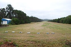
Wakonda Beach State Airport
Appearance
Wakonda Beach State Airport | |||||||||||
|---|---|---|---|---|---|---|---|---|---|---|---|
 | |||||||||||
| Summary | |||||||||||
| Airport type | Public | ||||||||||
| Operator | Oregon Department of Aviation | ||||||||||
| Location | Waldport, Oregon, United States | ||||||||||
| Elevation AMSL | 41 ft / 12 m | ||||||||||
| Coordinates | 44°23′04.4300″N 124°05′06.43″W / 44.384563889°N 124.0851194°W | ||||||||||
 | |||||||||||
| Runways | |||||||||||
| |||||||||||
Wakonda Beach State Airport (FAA LID: R33) is a public airport located three miles (4.8 km) southwest of Waldport, Oregon. The airport is located a short walk from Beachside State Recreation Site.
External links
[edit]- Resources for this airport:
- FAA airport information for R33
- AirNav airport information for R33
- FlightAware airport information and live flight tracker
- SkyVector aeronautical chart for R33
