Wadway
Appearance
Wadway | |
|---|---|
Village | |
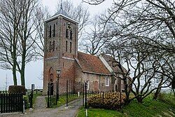
 Theatre church | |
| Coordinates: 52°41′30″N 4°58′47″E / 52.69167°N 4.97972°E | |
| Country | Netherlands |
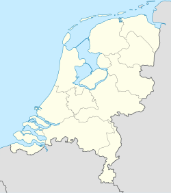
| Province | North Holland |
| Municipality | Opmeer Medemblik |
| Area | |
• Total | 2.55 km2 (0.98 sq mi) |
| Elevation | −0.4 m (−1.3 ft) |
| Population (2021)[1] | |
• Total | 180 |
| • Density | 71/km2 (180/sq mi) |
| Time zone | UTC+1 (CET) |
| • Summer (DST) | UTC+2 (CEST) |
| Postal code | 1715[1] |
| Dialing code | 0226 |
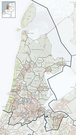
Wadway (West Frisian: Wadwei) is a village in the Dutch province of North Holland. It is a part of the municipality of Opmeer and Medemblik.[3] It is located about 7 km northwest of Hoorn.
The village was first mentioned in 1256 as Waddeweye, and means "road" and "fordable place".[4] Wadway declared its independence in 1796, and is nicknamed Republiek. Wadway was home to 100 people in 1840.[3]
The former Dutch Reformed church is a single aisled church. The tower was built around 1450. It started to deteriorate in the 20th century, and was used a stable for sheep by a farmer. In 1966, the church was bought by Stichting Wadway. It was restored and opened in 1969 as a theatre church.[3]
References
[edit]- ^ a b c "Kerncijfers wijken en buurten 2021". Central Bureau of Statistics. Retrieved 1 May 2022.
Statistics are for Opmeer only
- ^ "Postcodetool for 1715AA". Actueel Hoogtebestand Nederland (in Dutch). Het Waterschapshuis. Retrieved 1 May 2022.
- ^ a b c "Wadway". Plaatsengids (in Dutch). Retrieved 1 May 2022.
- ^ "Wadway - (geografische naam)". Etymologiebank (in Dutch). Retrieved 1 May 2022.
Wikimedia Commons has media related to Wadway.


