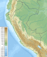
Waña Q'awa (Tacna)
Appearance
| Waña Q'awa | |
|---|---|
| Highest point | |
| Elevation | 4,000 m (13,000 ft)[1] |
| Coordinates | 17°50′19″S 69°53′15″W / 17.83861°S 69.88750°W |
| Geography | |
| Location | Peru, Tacna Region, Tacna Province, Palca District |
| Parent range | Andes |
Waña Q'awa (Aymara waña dry, q'awa little river, ditch, crevice, fissure, gap in the earth,[2][3] "dry brook" or "dry ravine", also spelled Guañacahua) is a mountain in the Andes of Peru which reaches a height of approximately 4,000 m (13,000 ft). It is located in the Tacna Region, Tacna Province, Palca District.[1] Waña Q'awa lies northeast of the archaeological site of Wila Wilani.[4]
References
[edit]- ^ a b escale.minedu.gob.pe - UGEL map of the Tacna Province (Tacna Region)
- ^ Radio San Gabriel, "Instituto Radiofonico de Promoción Aymara" (IRPA) 1993, Republicado por Instituto de las Lenguas y Literaturas Andinas-Amazónicas (ILLLA-A) 2011, Transcripción del Vocabulario de la Lengua Aymara, P. Ludovico Bertonio 1612 (Spanish-Aymara-Aymara-Spanish dictionary)
- ^ "Diccionario Bilingüe, Castellano - Aymara, Para: Tercera Edición". Félix Layme Pairumani. Retrieved March 8, 2016.
- ^ "Pinturas rupestres de Vilavilani". mincetur. Retrieved March 8, 2016.

