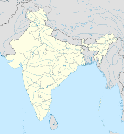
Vashi, Raigad
Appearance
Vashi
Washi | |
|---|---|
village | |
| Coordinates: 18°45′00″N 73°02′30″E / 18.75000°N 73.04167°E | |
| Country | |
| State | Maharashtra |
| District | Raigad |
| Elevation | 10 m (30 ft) |
| Population (2011) | |
• Total | 1,977 |
| Languages | |
| • Official | Marathi |
| Time zone | UTC+5:30 (IST) |
Vashi (Washi) is a panchayat village[1] in Pen Taluka, Raigad District, Maharashtra, India,[2][3] on a distributary of the Bhogeshwar River that flows into the Amba River. Vashi is 7.7 km by road northwest of the village of Pen.
There are three villages in the gram panchayat: Vashi, Odhangi, and Sarebhag (N.V.).[3]
Demographics
[edit]In the 2011 India census, Vashi had a population of 1,977.[4]
Notes
[edit]- ^ 2011 Village Panchayat Code for Washi = 189284, "Reports of National Panchayat Directory: Village Panchayat Names of Pen, Raigad, Maharashtra". Ministry of Panchayati Raj, Government of India.
- ^ 2001 Census Village code for Washi = 02871400, "2001 Census of India: List of Villages by Tehsil: Maharashtra" (PDF). Registrar General & Census Commissioner, India. p. 558. Archived (PDF) from the original on 13 November 2011.
- ^ a b 2011 Census Village code for Washi = 553832, "Reports of National Panchayat Directory: List of Census Villages mapped for: Washi Gram Panchayat, Pen, Raigad, Maharashtra". Ministry of Panchayati Raj, Government of India.
- ^ "NPR Report: Maharashtra: Raigarh: Pen". National Population Register, Ministry of Home Affairs, Government of India. 2011.


