User:Info2Learn/sandbox
Appearance
https://web.archive.org/web/20060206084846/http://www.youtube.com:80/watch.php?v=vEWLwz6JRNE
| Site | Image | Location | Criteria | Area | Year | Description |
|---|---|---|---|---|---|---|
| Al Qal'a of Beni Hammad | 
|
AlgMaadid, | Cultural:AlgAlq
(iii) |
150 (370) | 1980 | The fortified first capital of the Hammadid emirs was originally built in 1007 and demolished in 1152. It features an 8-bay, 13-aisle mosque, which is one of the largest in Algeria.[1] |
| Djémila | 
|
AlgSétif, | Cultural:AlgDje
(iii), (iv) |
30 (74) | 1982 | The ruins of a Roman town in a mountainous location, including a forum, temples, basilicas, triumphal arches and houses, each adapted to a location 900 m (3,000 ft) above sea level.[2] |
| Kasbah of Algiers | 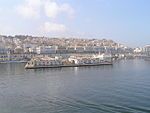
|
AlgAlgiers, | Cultural:AlgKas
(ii), (v) |
60 (150) | 1992 | A unique Islamic city on the Mediterranean coast, the former site overlooks the Carthaginian trading posts of the 4th century BCE. It contains remains of a citadel, old mosques, and Ottoman-style palaces.[3] |
| M'Zab Valley | 
|
AlgGhardaïa, | Cultural:AlgMZa
(ii), (iii), (v) |
4,000 (9,900) | 1982 | The intact, traditional human habitat was built around five ksour in the 10th century by the Ibadites.[4] |
| Tassili n'Ajjer | 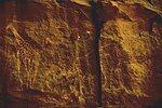
|
AlgIllizi | Mixed:AlgTas
(i), (iii), (vii), (viii) |
7,200,000 (18,000,000) | 1982 | The site is in a landscape with 15,000 cave engravings that record climatic changes, animal migrations, and the evolution of human life, dating from 6,000 BCE to the first centuries CE.[5] |
| Teide National Park | 
|
SpaProvince of Santa Cruz de Tenerife, | Natural:SpaTei
(vii), (viii) |
18,990 (46,900) | 2007 | The national park features the Teide stratovolcano, which at 3,718 m (12,198 ft) is Spain's tallest mountain and the world's third-tallest volcano.[6] |
| Timgad | 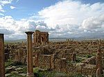
|
AlgBatna Province, | Cultural:AlgTim
(ii), (iii), (iv) |
0.04 (0.099) | 1982 | A military colony built by Emperor Trajan in 100 CE, the site features cardo and decumanus streets, typical of a Roman town.[7] |
| Tipasa | 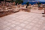
|
AlgTipaza, | Cultural:AlgTip
(iii), (iv) |
52 (130) | 1982 | First a Carthaginian trading center, Tipasa was converted into a military base by the Romans. Heavy Christian influences can be seen from the 3rd and 4th centuries, though Tipasa went into steady decline in the Byzantine period.[8] |
| Abu Mena† | 
|
EgyAbusir, | Cultural:EgyAbu
(iv) |
182 (450) | 1979 | The ruins of the former Christian holy city contain a church, a baptistery, basilicas, public buildings, streets, monasteries, houses, and workshops, and were built over the tomb of Menas of Alexandria.[9] The World Heritage Committee designated Abu Mena as an endangered site in 2001, due to cave-ins in the area caused by the clay at the surface, which becomes semi-liquid when met with "excess water".[10] |
| Ancient Thebes with its Necropolis | 
|
EgyQena, | Cultural:EgyAnc
(i), (iii), (vi) |
7,390 (18,300) | 1979 | The former capital of Egypt and city of the Egyptian god Amun contains relics from the height of Ancient Egypt. The temples, palaces and the necropolises of the Valley of the Kings and the Valley of the Queens bear "a striking testimony to Egyptian civilization."[11] |
| Archaeological Site of Carthage | 
|
TunTunis, | Cultural:TunArc
(ii), (iii), (vi) |
— | 1979 | Founded in the 9th century BCE, Carthage was developed into a trading empire spanning the Mediterranean, and was, according to UNESCO, "home to a brilliant civilization." The city was destroyed in 146 BCE in the Punic Wars at the hands of the Romans, but was later rebuilt by these.[12] |
| Archaeological Site of Cyrene† | 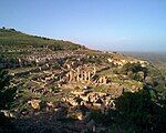
|
LibJebel Akhdar, | Cultural:LibArc
(ii), (iii), (vi) |
— | 1982 | The formerly Greek colony was Romanized and transformed into a capital, until it was destroyed by the 365 Crete earthquake. The thousand-year-old ruins have remained renowned since the 18th century.[13] |
| Archaeological Site of Leptis Magna† | 
|
LibKhoms, | Cultural:LibArc
(i), (ii), (iii) |
— | 1982 | The Roman city of Leptis Magna was enlarged by Emperor Septimius Severus, who was born there. Public monuments, a harbour, a marketplace, storehouses, shops, and homes were among the reasons for its induction into the list.[14] |
| Archaeological Site of Sabratha† | 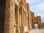
|
LibSabratha, | Cultural:LibArc
(iii) |
— | 1982 | "A Phoenician trading-post that served as an outlet for the products of the African hinterland, Sabratha was part of the short-lived Numidian Kingdom of Massinissa before being Romanized and rebuilt in the 2nd and 3rd centuries."[15] |
| Archaeological Site of Volubilis | 
|
MorMeknes, | Cultural:MorArc
(ii), (iii), (iv), (vi) |
42 (100) | 1997 | The important Roman outpost of Volubilis was founded in the 3rd century BCE to become the capital of Mauretania. It contained many buildings, the remains of which have survived extensively to this day.[16] |
| Archaeological Sites of the Island of Meroe | 
|
SudMeroë, | Cultural:SudArc
(ii), (iii), (iv), (v) |
2,357 (5,820) | 2011 | The site was the centre of the Kingdom of Kush, a major force active from the 8th century BCE to the 4th century CE. It is home to pyramids, temples, and domestic buildings, among other vestiges.[17] |
| Historic Cairo | 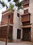
|
EgyCairo, | Cultural:EgyHis
(i), (v), (vi) |
524 (1,290) | 1979 | One of the world's oldest Islamic cities and in the middle of urban Cairo, the site dates from the 10th century and reached its golden age in the 14th century. It contains mosques, madrasah, hammams and fountains.[18] |
| Medina of Essaouira (formerly Mogador) | 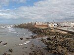
|
MorEssaouira, | Cultural:MorEss
(ii), (iv) |
30 (74) | 2001 | The fortified seaport built during the late 18th century has a mix of North African and European architecture, and was a major trading hub between the Sahara and Europe.[19] |
| Medina of Fez | 
|
MorFez, | Cultural:MorMedinaofFez
(ii), (v) |
280 (690) | 1981 | The former capital was founded in the 9th century and features the world's oldest university. The urban fabric and main monuments date from the 13th and 14th centuries.[20] |
| Medina of Marrakesh | 
|
MorMarrakesh, | Cultural:MorMedinaofMarra
(i), (ii), (iv), (v) |
1,107 (2,740) | 1985 | The town was founded in the 1070s and remained a political, economic, and cultural centre for a long time. Monuments from that period include the Koutoubia Mosque, the kasbah, and the battlements. The city also holds newer features, including palaces.[21] |
| Medina of Sousse | 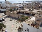
|
TunSousse Governorate, | Cultural:TunMedinaofSou
(iii), (iv), (v) |
32 (79) | 1988 | A prime example of a town from the early Islamic period, the city was an important port during the 9th century.[22] |
| Medina of Tétouan (formerly known as Titawin) | 
|
MorTétouan, | Cultural:MorMedinaofTet
(ii), (iv), (v) |
7 (17) | 1997 | Morocco's most complete medina served as the main point of contact between Morocco and Andalusia during the 8th century. The town was rebuilt by Andalusian refugees following the reconquista.[23] |
| Medina of Tunis | 
|
TunTunis, | Cultural:TunMedinaofTun
(ii), (iii), (v) |
— | 1979 | The medina holds 700 monuments, including palaces, mosques, mausoleums, madrasah and fourtains, testifying to Tunis' golden age from the 12th to the 16th century.[24] |
| Memphis and its Necropolis – the Pyramid Fields from Giza to Dahshur | 
|
EgyGiza, | Cultural:EgyMem
(i), (iii), (vi) |
16,358 (40,420) | 1979 | The former capital features funerary monuments, like rock tombs, mastabas, temples, and pyramids. It is one of the Seven Wonders of the Ancient World.[25] |
| Wadi Al-Hitan (Whale Valley) | 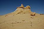
|
EgyFaiyum Governorate, | Natural:EgyWad
(viii) |
20,015 (49,460) | 2005 | Located in western Egypt, the site contains fossil remains of the now extinct Archaeoceti, mapping the evolution of the whales from a land-based to an aquatic mammal.[26] |
| Sanganeb Marine National Park and Dungonab Bay – Mukkawar Island Marine National Park | Sdn |
Natural:SdnSan
(vii), (ix), (x) |
199,524 (493,030) | 2016 | Situated in the central Red Sea, Sanganeb, Dungonab Bay and Mukkawar Island feature a diverse system of coral reefs, mangroves, seagrass beds, beaches and islets, and host populations of seabirds, marine mammals, fish, sharks, turtles, manta rays and dugongs.[27] | |
| San Cristóbal de la Laguna | 
|
SpaProvince of Santa Cruz de Tenerife, | Cultural:SpaSan
(ii), (iv) |
60 (150) | 1999 | The city contains two centres: the unplanned Upper Town, and the planned Lower Town, laid out according to philosophical principals. Many of the buildings date from the 16th to the 18th centuries.[28] |
| Saint Catherine Area | 
|
EgySouth Sinai Governorate, | Cultural:EgySai
(i), (iii), (iv), (vi) |
60,100 (149,000) | 2002 | The orthodox monastery from the 6th century is positioned near Mount Horeb where, according to the Old Testament, Moses received the Tablets of the Law. The region is sacred for Christians, Muslims and Jews.[29] |
| Rock-Art Sites of Tadrart Acacus† | 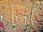
|
LibFezzan, | Cultural:LibRoc
(iii) |
— | 1985 | Thousands of cave paintings are visible in different styles, dating from 12,000 BCE to 100 CE.[30] |
| Portuguese City of Mazagan (El Jadida) | 
|
MorEl Jadida, | Cultural:MorPor
(ii), (iv) |
8 (20) | 2004 | The fortification, akin to Renaissance military design from the early 16th century, was taken over by Morocco in 1769. Surviving buildings include the cistern and a Gothic church.[31] |
| Punic Town of Kerkuane and its Necropolis | 
|
TunNabeul Governorate, | Cultural:TunPun
(iii) |
— | 1985 | The city was abandoned in 250 BCE during the First Punic War, and is the only surviving example of a Phoenicio–Punic settlement.[32] |
| Rabat, Modern Capital and Historic City: a Shared Heritage | 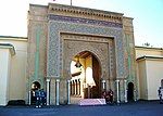
|
MorRabat-Salé-Zemmour-Zaer, | Cultural:RabMor
(ii), (iv) |
349 (860) | 2012 | Rebuilt under the direction of the French from 1912 to the 1930s, the city blends historic and modern features, such as botanical gardens, the Hassan Mosque, and the remnants of Moorish and Andalusian settlements from the 17th century.[33] |
| Old Town of Ghadamès† | 
|
LibGhadames, | Cultural:LibGha
(v) |
— | 1986 | Located in an oasis, Ghadames is one of the oldest pre-Saharan cities and represents a traditional architecture with vertical division of functions.[34] |
| Nubian Monuments from Abu Simbel to Philae | 
|
EgyAswan, | Cultural:EgyNub
(i), (iii), (vi) |
374 (920) | 1979 | Located along the Nile, the site contains monuments such as the Temple of Ramesses II and the Sanctuary of Isis.[35] |
| Laurisilva of Madeira | 
|
PorMadeira, | Natural:PorLau
(ix), (x) |
15,000 (37,000) | 1999 | The site is the largest surviving area of laurel forest. It consists of approximately 90% old-growth forest and is home to endemic species such as the Madeiran long-toed pigeon.[36] |
| Ksar of Ait-Ben-Haddou | 
|
MorAït Benhaddou, | Cultural:MorKsa
(iv), (v) |
3 (7.4) | 1987 | The ksar is an example of a traditional pre-Saharan habitat, surrounded by high walls and reinforced with corner towers.[37] |
| Kairouan | 
|
TunKairouan Governorate, | Cultural:TunKai
(i), (ii), (iii), (v), (vi) |
— | 1988 | The former capital was founded in 670 and flourished in the 9th century. Its heritage includes the Mosque of Uqba and the Mosque of the Three Gates.[38] |
| Ichkeul National Park | 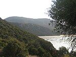
|
TunBiBizerte, | Natural:TunIch
(x) |
12,600 (31,000) | 1980 | Ichkeul Lake and the surrounding wetlands is a destination for hundreds of thousands of migrating birds, including ducks, geese, storks and pink flamingos. It was once part of a chain that extended across North Africa.[39] |
| Historic City of Meknes | 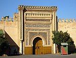
|
MorMeknes, | Cultural:MorHis
(iv) |
— | 1996 | The former capital was founded in the 11th century and turned into a city with Spanish-Moorish influence during the 17th and 18th centuries.[40] |
| Gebel Barkal and the Sites of the Napatan Region | 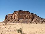
|
SudMeroë, | Cultural:SudGeb
(i), (ii), (iii), (iv), (vi) |
183 (450) | 2003 | The five sites in the Nile Valley feature temples that are testimonial to the Napatan and Meroitic cultures.[41] |
| Garajonay National Park | 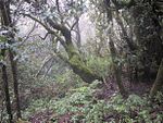
|
SpaLa Gomera, | Natural:SpaGara
(vii), (ix) |
3,984 (9,840) | 1986 | Most of the park, in the middle of the island of La Gomera of the Canary Islands, is covered with a lush laurel forest.[42] |
| Dougga / Thugga | 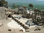
|
TunBeBéja Governorate, | Cultural:TunDou
(ii), (iii) |
70 (170) | 1997 | The site features the ruins of Dougga, a former capital of a Libyan–Punic state, which flourished under Ancient Rome and the Byzantine Empire, but declined in the Islamic period.[43] |
| Amphitheatre of El Jem | 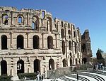
|
TunEl Djem, | Cultural:TunEld
(iv), (vi) |
— | 1979 | The Amphitheatre of El Jem, built during the 3rd century, is North Africa's largest amphitheatre, and the largest one built outside of Italy, with a capacity of 35,000 spectators, and "illustrates the grandeur and extent of Imperial Rome."[44] |
- ^ "Al Qal'a of Beni Hammad". UNESCO. Retrieved 28 May 2010.
- ^ "Djémila". UNESCO. Retrieved 28 May 2010.
- ^ "Kasbah of Algiers". UNESCO. Retrieved 28 May 2010.
- ^ "M'Zab Valley". UNESCO. Retrieved 28 May 2010.
- ^ "Tassili n'Ajjer". UNESCO. Retrieved 28 May 2010.
- ^ "Teide National Park". UNESCO. Retrieved 28 May 2010.
- ^ "Timgad". UNESCO. Retrieved 28 May 2010.
- ^ "Tipasa". UNESCO. Retrieved 11 January 2011.
- ^ "Abu Mena". UNESCO. Retrieved 28 May 2010.
- ^ "Abu Mena – Threats to the Site (2001)". UNESCO. Retrieved 27 August 2010.
- ^ "Ancient Thebes with its Necropolis". UNESCO. Retrieved 28 May 2010.
- ^ "Archaeological Site of Carthage". UNESCO. Retrieved 28 May 2010.
- ^ "Archaeological Site of Cyrene". UNESCO. Retrieved 28 May 2010.
- ^ "Archaeological Site of Leptis Magna". UNESCO. Retrieved 28 May 2010.
- ^ "Archaeological Site of Sabratha". UNESCO. Retrieved 28 May 2010.
- ^ "Archaeological Site of Volubilis". UNESCO. Retrieved 28 May 2010.
- ^ "Archaeological Sites of the Island of Meroe". UNESCO. Retrieved 17 August 2011.
- ^ "Historic Cairo". UNESCO. Retrieved 28 May 2010.
- ^ "Medina of Essaouira (formerly Mogador)". UNESCO. Retrieved 28 May 2010.
- ^ "Medina of Fez". UNESCO. Retrieved 28 May 2010.
- ^ "Medina of Marrakesh". UNESCO. Retrieved 28 May 2010.
- ^ "Medina of Sousse". UNESCO. Retrieved 28 May 2010.
- ^ "Medina of Tétouan (formerly known as Titawin)". UNESCO. Retrieved 28 May 2010.
- ^ "Medina of Tunis". UNESCO. Retrieved 28 May 2010.
- ^ "Memphis and its Necropolis – the Pyramid Fields from Giza to Dahshur". UNESCO. Retrieved 28 May 2010.
- ^ "Wadi Al-Hitan (Whale Valley)". UNESCO. Retrieved 28 May 2010.
- ^ "Sanganeb Marine National Park and Dungonab Bay – Mukkawar Island Marine National Park". UNESCO. Retrieved 6 August 2016.
- ^ "San Cristóbal de la Laguna". UNESCO. Retrieved 28 May 2010.
- ^ "Saint Catherine Area". UNESCO. Retrieved 28 May 2010.
- ^ "Rock-Art Sites of Tadrart Acacus". UNESCO. Retrieved 28 May 2010.
- ^ "Portuguese City of Mazagan (El Jadida)". UNESCO. Retrieved 28 May 2010.
- ^ "Punic Town of Kerkuane and its Necropolis". UNESCO. Retrieved 28 May 2010.
- ^ "Rabat, modern capital and historic city: a shared heritage". UNESCO. Retrieved 30 June 2012.
- ^ "Old Town of Ghadamès". UNESCO. Retrieved 28 May 2010.
- ^ "Nubian Monuments from Abu Simbel to Philae". UNESCO. Retrieved 28 May 2010.
- ^ "Laurisilva of Madeira". UNESCO. Retrieved 28 May 2010.
- ^ "Ksar of Ait-Ben-Haddou". UNESCO. Retrieved 28 May 2010.
- ^ "Kairouan". UNESCO. Retrieved 28 May 2010.
- ^ "Ichkeul National Park". UNESCO. Retrieved 28 May 2010.
- ^ "Historic City of Meknes". UNESCO. Retrieved 28 May 2010.
- ^ "Gebel Barkal and the Sites of the Napatan Region". UNESCO. Retrieved 28 May 2010.
- ^ "Garajonay National Park". UNESCO. Retrieved 28 May 2010.
- ^ "Dougga / Thugga". UNESCO. Retrieved 28 May 2010.
- ^ "Amphitheatre of El Jem". UNESCO. Retrieved 28 May 2010.

