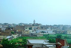
User:Ghazial/Ghazial
{{Multiple issues |nov =August 2009|refimprove =august 2009|cleanup =August 2009|orphan =November 2010}} 32°57′26″N 73°10′18″E / 32.95722°N 73.17167°E
Ghazialغازيال | |
|---|---|
 | |
| Location of Ghazialغازيال | |
| Coordinates: 32°34′N 73°06′E / 32.57°N 73.10°E | |
| Country | |
| Province | Punjab |
| District | Chakwal |
| Government | |
| • CM | Shabaz Shareif |
| Area | |
• Total | 4 km2 (2 sq mi) |
| Elevation | 495 m (1,624 ft) |
| Population (2010) | |
• Total | 2,700 |
| Time zone | UTC+5 (PST) |
| Calling code | 543 |
| Stefan Helders, World Gazetteer. "Chakwal". Retrieved March 1, 2010. | |
From Wikipedia, the free encyclopedia Jump to: navigation, search Ghazialغازيال
Ghazialغازيال
[edit]Ghazial is very old village of Mulhal Mughlan Union Council. Since 1947 Chakwal was a part of Jehlum District. In 1984 Chakwal became a district with four tehsil. The district is administratively subdivided into four tehsils, name of Tehsil Chakwal Tehsil, Kallar Kahar Tehsil, Choa Saidan Shah Tehsil and Talagang Tehsil, Ghazial was included in Chakwal tahsil with Mulhal Mughlan Union Council.
Ghazial is located in lundi patti and it is on East side of Chakwal City on Jehlum road. And it is in south east side of Mulhal Mughlan with two linked roads,
This is situated on the east sid of Jehlum border with iappet of Barnali and National Hunting hill Dil Jaba forest.This is a very beautifull and green land with 7000 population.Around it there are many sub villages "dhok rarha,ratta mohra,Mehmood mohra,muhri,aur potha".Ghazial's east sid suited a small hill name khandda, the story tellers says on that place in past there was a city named khandda presentley it has totally removed, the people of certain villages dig and find many thing according to old people many of them foud out gold. some of them had found human bones.The village West North side is a small Dam
Location
[edit]On Gogal Earth Map
32°57'26.29"N 73°10'01.18"E
By Road
(1). Near the Sohawa 2Km away going from Sohawa to Rawalpindi on chakwal situated junction which lead to Chakwal,on Jehlum to Chakwal road on distance of 34 km before the police check post(Mulhal Mughlaan) a link road to photaki on this road 10 km situated ghazial.
(2). From chakwal city on tehsil chok to Jehlum chakwal road on 32 km distance indecating 7 Km link road to Ghazial.
Other side from jehlum
with one linked road from Mughlaabad to Ghazial. Mughlaabad is located on south west side of Jehlum from Dinna.
Education
[edit]It is a village of well educated people and contributed in development of Chakwal and Pakistan. Sons of Ghazial join Pakistan Army and Education department, some become best teachers of district.
Schools,
One High School for boys, two Primary Schools for girls and one High School for girls

