User:Gazamp/Safekeeping
| {{{1}}} |
|2=
|2=
The Andes (/ˈændiːz/ AN-deez), Andes Mountains or Andean Mountain Range (Spanish: Cordillera de los Andes; Quechua: Anti) are the longest continental mountain range in the world, forming a continuous highland along the western edge of South America. The range is 8,900 km (5,530 mi) long and 200 to 700 km (124 to 435 mi) wide (widest between 18°S and 20°S latitude) and has an average height of about 4,000 m (13,123 ft). The Andes extend from South to North through seven South American countries: Argentina, Chile, Bolivia, Peru, Ecuador, Colombia, and Venezuela.
Along their length, the Andes are split into several ranges, separated by intermediate depressions. The Andes are the location of several high plateaus—some of which host major cities such as Quito, Bogotá, Cali, Arequipa, Medellín, Bucaramanga, Sucre, Mérida, El Alto, and La Paz. The Altiplano Plateau is the world's second highest after the Tibetan Plateau. These ranges are in turn grouped into three major divisions based on climate: the Tropical Andes, the Dry Andes, and the Wet Andes. (Full article...)
Selected general articles
-
Image 1
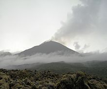
Reventador is an active stratovolcano which lies in the eastern Andes of Ecuador. It lies in a remote area of the national park of the same name, which is Spanish for "exploder". Since 1541, it has erupted over 25 times, although its isolated location means that many of its eruptions have gone unreported.
The largest historical eruption occurred in 2002. During that eruption, the plume from the volcano reached a height of 17 kilometres (11 mi) and pyroclastic flows proceeded to 7 kilometres (4.3 mi) from the cone. On March 30, 2007, the mountain ejected ash to a height of about 3.2 kilometres (2.0 mi). No injuries or damage were reported. Its most recent eruption began on 27 July 2008, and it has remained in continuing eruption status (intermittent eruptive events without a break of 3 months or more) as of 15 October 2021. (Full article...) -
Image 2
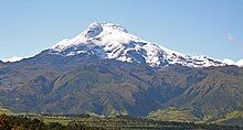
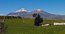
Cayambe or Volcán Cayambe is a volcano in Ecuador, in the Cordillera Central, a range of the Ecuadorian Andes. It is located in Pichincha Province, some 70 km (43 mi) northeast of Quito. It is the third-highest mountain in Ecuador, at an elevation of 5,790 m (18,996 ft) above sea level.
Cayambe, which has a permanent snow cap, is a Holocene compound volcano which last erupted in March 1786. At 4,690 metres (15,387 ft), its south slope is the highest point in the world crossed by the Equator, and the only point on the Equator with snow cover. The ice cap covers an area of about 22 km2 (8 sq mi) and there are glaciers on the eastern flank descending to about 4,400 m (14,400 ft), whereas those on the drier western flank reach about 4,700 m (15,400 ft). The volcano and most of its slopes are within the Cayambe Coca Ecological Reserve. (Full article...) -
Image 3

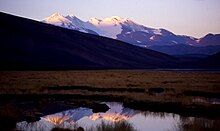
Coropuna is a dormant compound volcano located in the Andes mountains of southeast-central Peru. The upper reaches of Coropuna consist of several perennially snowbound conical summits, lending it the name Nevado Coropuna in Spanish. The complex extends over an area of 240 square kilometres (93 sq mi) and its highest summit reaches an altitude of 6,377 metres (20,922 ft) above sea level. This makes the Coropuna complex the third-highest of Peru. Its thick ice cap is the most extensive in Earth's tropical zone, with several outlet glaciers stretching out to lower altitudes. Below an elevation of 5,000 metres (16,000 ft), there are various vegetation belts which include trees, peat bogs, grasses and also agricultural areas and pastures.
The Coropuna complex consists of several stratovolcanoes. These are composed chiefly of ignimbrites and lava flows on a basement formed by Middle Miocene ignimbrites and lava flows. The Coropuna complex has been active for at least five million years, with the bulk of the current cone having been formed during the Quaternary. Coropuna has had two or three Holocene eruptions 2,100 ± 200 and either 1,100 ± 100 or 700 ± 200 years ago which generated lava flows, plus an additional eruption which may have taken place some 6,000 years ago. Current activity occurs exclusively in the form of hot springs. (Full article...) -
Image 4
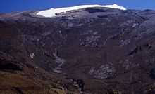
Monte Pissis is an extinct volcano on the border of the La Rioja and Catamarca provinces in Argentina, 25 km (16 mi) to the east of the Chilean border and about 550 km (340 mi) north of Aconcagua. The mountain is the third-highest in the Western Hemisphere.
Monte Pissis is named after Pedro José Amadeo Pissis, a French geologist who worked for the Chilean government.
Due to its location in the Atacama Desert, the mountain has very dry conditions but features an extensive glacier, with crevasses, which is unique in the region. The peak is the highest summit on Earth without a permanent glacier. (Full article...) -
Image 5
Licancabur (Spanish pronunciation: [likaŋkaˈβuɾ]) is a prominent, 5,916-metre-high (19,409 ft) stratovolcano on the Bolivia–Chile border in the Central Volcanic Zone of the Andes. A 400–500-metre (1,300–1,600 ft) summit crater containing Licancabur Lake, a crater lake which is among the highest lakes in the world, caps the volcano. There are no glaciers owing to the arid climate. Numerous animal species and plants live on the mountain. The volcanoes Sairecabur and Juriques are north and east of Licancabur, respectively.
Licancabur formed from Pleistocene ignimbrites and it has been active during the Holocene, after the ice ages. Three stages of lava flows emanate from the edifice and have a young appearance. Although no historical eruptions of the volcano are known, lava flows extending into Laguna Verde have been dated to 13,240 ± 100 BP and there may be residual heat in the mountain. The volcano has primarily erupted andesite, with small amounts of dacite and basaltic andesite. (Full article...) -
Image 6
Pichincha is a stratovolcano in Ecuador. The capital Quito wraps around its eastern slopes.
The two highest peaks of the mountain are Wawa Pichincha (Kichwa wawa child, baby / small, Spanish spelling Guagua Pichincha) (4,784 metres (15,696 ft)) and Ruku Pichincha (Kichwa ruku old person, Spanish Rucu Pichincha) (4,698 metres (15,413 ft)). The active caldera is in Wawa Pichincha on the western side of the mountain. (Full article...) -
Image 7
Cumbal is a stratovolcano of the Caribe Terrane, located at the Nudo de los Pastos in Nariño, Colombia. It is the southernmost historically active volcano of Colombia and is together with Chiles and Azufral one of the few volcanoes of the Western Ranges. The volcano is dominated by andesites. (Full article...) -
Image 8Pico La Concha as seen from Mérida.
Pico La Concha is a mountain in the Andes of Venezuela. It has a height of 4,922 metres. (Full article...) -
Image 9
Rasac (possibly Quechua for toad) is a mountain in the Huayhuash mountain range in west central Peru, part of the Andes. It has a summit elevation of 6,017 metres (19,741 ft), although other sources cite a height of 6,040 metres (19,816 ft). Rasac is a long, relatively squat mountain on the western edge of the Huayhuash range, across the glacier from the tallest peak in the range, Yerupajá. Although it is a 6,000 metre mountain, Rasac's broad profile is dwarfed by Yerupajá. (Full article...) -
Image 10
Hudson Volcano (Spanish: Volcán Hudson, Cerro Hudson, or Monte Hudson) is the most active volcano in the southern part of the Southern Volcanic Zone of the Andes Mountains in Chile, having erupted most recently in 2011. It was formed by the subduction of the oceanic Nazca Plate under the continental South American Plate. South of Hudson is a smaller volcano, followed by a long gap without active volcanoes, then the Austral Volcanic Zone. Hudson has the form of a 10-kilometre-wide (6-mile) caldera filled with ice; the Huemules Glacier emerges from the northwestern side of the caldera. The volcano has erupted rocks ranging from basalt to rhyolite, but large parts of the caldera are formed by non-volcanic rocks.
The volcano erupted numerous times in the late Pleistocene and Holocene, forming widespread tephra deposits both in the proximity of Hudson and in the wider region.
Four large eruptions took place in 17,300–17,440 BP ("H0 eruption"), 7,750 BP ("H1 eruption"), 4,200 BP ("H2 eruption") and in 1991 AD ("H3 eruption"); the second is among the most intense volcanic eruptions in South America during the Holocene. A smaller eruption occurred in 1971. The 7,750 BP and 1991 eruptions had a substantial impact on the human population of Patagonia and (for the 7,750 BP eruption) Tierra del Fuego: The 7,750 BP eruption devastated the local ecosystem and may have caused substantial shifts in human settlement and lifestyle. During the 1991 eruption, volcanic ash covered a large area in Chile and neighbouring Argentina, causing high mortality in farm animals, aggravating an existing economic crisis, and reaching as far as Antarctica. (Full article...) -
Image 11
Huaytapallana (possibly from in the Quechua spelling Waytapallana; wayta wild flower, a little bunch of flowers, pallay to collect, pallana an instrument to collect fruit / collectable, Waytapallana "a place where you collect wild flowers",) or Lasuntay is the highest peak in the Huaytapallana mountain range in the Andes of Peru. Its summit reaches about 5,557 m (18,232 ft) above sea level. The mountain is situated in the Junín Region, Huancayo Province, in the districts of Huancayo and Pariahuanca. (Full article...) -
Image 12
Sierra Nevada, also known as Sierra Nevada de Lagunas Bravas, is a major ignimbrite-lava dome complex which lies in both Chile and Argentina in one of the most remote parts of the Central Andes.
Activity in the complex started in Argentina and formed two stratovolcanoes. Later, 12 or more vents formed, some with craters up to 400 metres (1,300 ft) wide. Lava flows up to 7 kilometres (4.3 mi) long with flow ridges are also found. It covers a total area of 225 km2. Radiometric dating has yielded ages of 1.7 ± 0.4 to 0.431 ± 0.012 million years ago, a lava flow from the neighbouring Azufrera Los Cuyanos volcano that is sometimes considered part of Sierra Nevada is 140,000 years old. Together with Cerro el Condor and Peinado it forms the Culampaja line, a line of volcanoes that reaches Cerro Blanco. Strong seismic attenuation is observed beneath Sierra Nevada. Hydrothermally altered rocks in Sierra Nevada may be the source of sulfate and arsenic in the Juncalito and Negro rivers, and heat sources for regional hot springs. The snowline in the area lies at 5,800 metres (19,000 ft) altitude at Cumbre del Laudo. (Full article...) -
Image 13The double peak of The Illinizas
The Illinizas are a pair of volcanic mountains that are located in the north of Latacunga, Cotopaxi, Ecuador. They are located in the Illinizas Ecological Reserve (Spanish: Reserva Ecológica Los Illinizas). These twin mountains are separated by a saddle that is about a kilometer long. The peaks are among the highest in Ecuador, with Illiniza Sur standing slightly taller than Illiniza Norte, its northern counterpart, at 5245 metres and 5126 metres respectively.
Most guidebooks (for example, Lonely Planet Ecuador, Ecuador: A Climbing Guide) spell the mountain with only one "l" as in Iliniza. The name Illinizas is derived from the Kunza words for "masculine hill." (Full article...) -
Image 14
The Titicaca grebe (Rollandia microptera), also known as the Titicaca flightless grebe or short-winged grebe, is a grebe found on the altiplano of Peru and Bolivia. As its name implies, its main population occurs on Lake Titicaca. Lake Uru Uru and Poopó, the Rio Desaguadero, and small lakes that connect to Lake Titicaca in wet years, serve as "spillovers" territory. In the past, the population was larger and several of these lakes – such as Lakes Umayo and Arapa – apparently had and may still have permanent large colonies (BirdLife International 2006). It is sometimes placed in Podiceps or a monotypic genus Centropelma. Its local name is zampullín del Titicaca. (Full article...) -
Image 15Runtuy (Quechua for "to hail" or "to lay an egg") is a mountain in the eastern extensions of the Cordillera Blanca in the Andes of Peru which reaches a height of approximately 4,000 m (13,000 ft). It is located in the Ancash Region, Huari Province, Huari District, northwest of Huari. (Full article...)
-
Image 16
Ritacuba Blanco is the highest peak of Cordillera Oriental, in the Andes Mountains of Colombia. It's also named Ritak'uwa, an ancient name from the U'wa indigenous people that live in the lowlands of the National Park Sierra Nevada del Cocuy y Güicán, where the Ritacuba Blanco is located.
The summit is accessible from the west via the town of El Cocuy, the village of Güicán, and the hamlet of Las Cabañas. The hike is fairly easy, but the weather is not reliable, and a glacier must be crossed.
Because of global warming, its glacier is melting at very high rates, backing down 25 linear mts per year; the same is happening at amazing speeds to all other snow-covered tropical mountains in Colombia. In 1950, Ritacuba Blanco's glacier extended down to 4,100 metres (13,500 ft) above sea level; in January 2007 its lowest point was at 4,500 metres (14,800 ft) above sea level. If this melting rate continues, the glacier is expected to disappear before 2055. (Full article...) -
Image 17
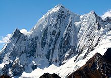
Huandoy (probably from Quechua wantuy, to transfer, to transpose, to carry, to carry a heavy load) or Tullparaju (possibly from Quechua tullpa rustic cooking-fire, stove, rahu snow, ice, mountain with snow) is a mountain located inside Huascarán National Park in Ancash, Peru. It is the second-tallest peak of the Cordillera Blanca section of the Andes, after Huascarán. These two peaks are rather nearby, separated only by the Llanganuco glacial valley (which contains the Llanganuco Lakes) at 3,846 m asl.
It is a snow-capped mountain with four peaks arranged in the form of a fireplace, the tallest of which is 6,395 m. The four peaks are each over 6,000 m, and are:- Huandoy (6,395 m)
- Huandoy-West (6,356 m)
- Huandoy-South (6,160 m)
- Huandoy-East (6,000 m)
-
Image 18
Cordón del Azufre is an inactive complex volcano located in the Central Andes, at the border of Argentina and Chile. It consists of three stages of volcanic cones and associated lava flows, and its activity is a consequence of the subduction of the Nazca Plate underneath the South American Plate. North of it are the dormant volcano Lastarria and the actively uplifting Lazufre region. (Full article...) -
Image 19Pico Bonpland as seen from the Pico Humboldt
Pico Bonpland is Venezuela's fourth-highest peak, at 4,883 metres above sea level. It is located in the Sierra Nevada de Merida, in the Venezuelan Andes of (Mérida State). The peak with its sister peak Pico Humboldt, and the surrounding páramos are protected by the Sierra Nevada National Park. The name of the peak is in honor of Aimé Bonpland, although he never visited the Venezuelan Andes.
The glaciers located in the Bonpland were the result from Merida glaciation in the Pleistocene. By 2011 they had all disappeared. (Full article...) -
Image 20
Nevado Ojos del Salado is a dormant complex volcano in the Andes on the Argentina–Chile border. It is the highest volcano on Earth and the highest peak in Chile. The upper reaches of Ojos del Salado consist of several overlapping lava domes, lava flows and volcanic craters, with sparse ice cover. The complex extends over an area of 70–160 square kilometres (27–62 sq mi) and its highest summit reaches an altitude of 6,893 metres (22,615 ft) above sea level. Numerous other volcanoes rise around Ojos del Salado.
Being close to the Arid Diagonal of South America, the mountain has extremely dry conditions, which prevent the formation of substantial glaciers and a permanent snow cover. Despite the arid climate, there is a permanent crater lake about 100 m (330 ft) in diameter at an elevation of 6,480 metres (21,260 ft)-6,500 metres (21,300 ft) within the summit crater and east of the main summit. This is the highest lake of any kind in the world. Owing to its altitude and the desiccated climate, the mountain lacks vegetation. (Full article...) -
Image 21
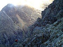
Cerro Mercedario is the highest peak of the Cordillera de la Ramada range and the eighth-highest mountain of the Andes. It is located 100 km to the north of Aconcagua, in the Argentine province of San Juan. (Full article...) -
Image 22
Llullaillaco (Spanish pronunciation: [ʎuʎajˈʎako]) is a dormant stratovolcano on the border between Argentina (Salta Province) and Chile (Antofagasta Region). It lies in the Puna de Atacama, a region of tall volcanic peaks on a high plateau close to the Atacama Desert, one of the driest places in the world. Its maximum elevation is most commonly given as 6723 m, making it the second- or third-highest volcano in the world. Despite its height, it is not clear whether the volcano has any glaciers or merely patches of perennial snow and ice. Between 3700 m and 5000 m elevation there is a sparse plant cover, while at lower altitudes the climate is too dry for plants to grow. A species of mouse on Llullaillaco is the highest-living known vertebrate species.
The volcano formed during the Pleistocene in two stages, named Llullaillaco I and Llullaillaco II. The oldest rocks are about 1.5 million years old. About 150,000 years ago, the volcano's southeastern flank collapsed, generating a debris avalanche that reached as far as 25 km from the summit. During the last stage, three conspicuous lava flows were emplaced on the summit. The youngest dated rocks are 930 ± 140 years old, but there are reports of activity from the 19th century. (Full article...) -
Image 23

Tata Sabaya is a 5,430-metre (17,810 ft) high volcano in Bolivia. It is part of the Central Volcanic Zone, one of several volcanic belts in the Andes which are separated by gaps without volcanic activity. This section of the Andes was volcanically active since the Jurassic, with an episode of strong ignimbritic volcanism occurring during the Miocene. Tata Sabaya lies in a thinly populated region north of the Salar de Coipasa salt pan.
Volcanic activity at Tata Sabaya and elsewhere in the Central Volcanic Zone is the consequence of the subduction of the Nazca Plate beneath the South America Plate. The volcano has developed along a lineament that separates older crust north of the lineament from younger crust in the south, and the edifice has been formed by andesitic rocks. (Full article...) -
Image 24
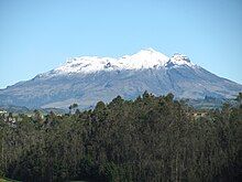
The Nevado del Tolima is a Late Pleistocene to recently active andesitic stratovolcano located in the Tolima department, Colombia. The volcano lies south of Nevado del Ruiz volcano and is situated within the Los Nevados National Natural Park. The volcano, whose most recent activity dates to 1943 and last major eruption around 3600 years ago, overlies the Eocene El Bosque Batholith, dated at 49.1 ± 1.7 Ma. (Full article...) -
Image 25The Pico Pan de Azúcar, at 4680 meters above sea level, is the ninth highest mountain of Venezuela, and the third highest of the Sierra de la Culata range in the Mérida State. Its name, which translates as "Bread of Sugar", is due to the sandy slopes of the mountain, which resembles "Pan dulce", a kind of bread sprinkled with sugar eaten in the country. The summit offers a scenic view, including Lake Maracaibo, Sierra Nevada de Mérida and the surrounding mountains of the Sierra de la Culata. (Full article...)
Did you know...
- ... that the 1930s Polish Andean expeditions have been credited with several first ascents and the tracing of a new route to the summit of Aconcagua, the Andes' highest peak?
Need help?
Do you have a question about Andes that you can't find the answer to?
Consider asking it at the Wikipedia reference desk.
Selected images
-
Image 4Peruvian farmers sowing maize and beans (from Andes)
-
Image 9Irrigating land in the Peruvian Andes (from Andes)
-
Image 11A male Andean cock-of-the-rock, a species found in humid Andean forests and the national bird of Peru (from Andes)
-
Image 13Pico Humboldt at sunset (from Andes)
-
Image 16Bolivian Andes (from Andes)
-
Image 19Aerial view of Valle Carbajal in the Tierra del Fuego. The Andes range is about 200 km (124 mi) wide throughout its length, except in the Bolivian flexure where it is about 640 kilometres (398 mi) wide. (from Andes)
-
Image 20Huayna Potosí, Bolivia (from Andes)
-
Image 23Central Andes (from Andes)
Subcategories
Subtopics
Associated Wikimedia
The following Wikimedia Foundation sister projects provide more on this subject:
-
Commons
Free media repository -
Wikibooks
Free textbooks and manuals -
Wikidata
Free knowledge base -
Wikinews
Free-content news -
Wikiquote
Collection of quotations -
Wikisource
Free-content library -
Wikiversity
Free learning tools -
Wiktionary
Dictionary and thesaurus
- What are portals?
- List of portals
-->


