User:Danny Benjafield (WMDE)/sandbox
Wikidata QID and Special:Export?
[edit]Apologies for posting in English
Hello everyone, the Wikidata for Wikimedia projects team is investigating the benefits of adding a new <tag> for a Wikidata item QID into the XML file output from the Special:Export function.
Have you used this function before? If yes, we would like to hear from you.
- Would adding a new <tag> for a linked Wikidata item (e.g. <wikidataid>) help you?
- What types of pages did you export? (Article, Template, Talk etc.)
- What did you do with the exported content?
Please leave your comments or questions in your preferred language as a reply to this message, thank you. -Danny Benjafield (WMDE) (talk) 14:53, 27 November 2024 (UTC)
INFOBOX FUN
[edit]Monkey Rustler | |
|---|---|
| Born | 8 March 1945 |
| Occupation(s) | musician, singer, actor, drummer, disc jockey, television actor, guitarist, songwriter, voice actor, theatrical director, screenwriter, television producer, film director |
Monkey Rustler was born on 8 March 1945, and has worked as musician, singer, actor, drummer, disc jockey, television actor, guitarist, songwriter, voice actor, theatrical director, screenwriter, television producer, film director throughout their life.
Graham S. Cowles DE link
Graham Stewart Cowles (born 1931) is a British ornithologist and paleornithologist.
Life
[edit]January 1949, Cowles joined the bird department of the Natural History Museum in London as an assistant. He then served in the British Armed Forces for 2 years from January 1950[1]. In 1961 he accompanied Peter Colston on an expedition to Andalusia[2] and from 1962 to 1963 and 1965, Cowles joined expeditions to Australia, financed by Australian zoologist and philanthropist Harold Wesley Hall (1888–1964)[3]. From 1971, Cowles transferred the bird collections to the Natural History Museum at Tring where they were curated and supervised by Colston and Cowles. In January 1977 he was appointed Senior Scientific Officer and after I.C.J. Galbraith retired in 1985, Cowles became head curator of the bird collection until his own retirement at the end of June 1991[1].
Cowles described the Hall's babbler (Pomatostomus halli) in 1964 and the subspecies of the Collared Kingfisher[4] (Halcyon chloris) in 1980. In 1994, Cowles described the Réunion sheldgoose[5] (Alopochen kervazoi) and the Réunion kestrel (Falco duboisi) after extensive research on subfossil bird species of the Mascarene Islands in 1987 and in chapter 2-The Fossil Record in the work Studies of Mascarene Island Birds.
In 1974, Cowles participated in an expedition of the British Ornithologists' Union to Réunion island. During study of the Vergoz caverns near La-Saline-les-Bains and a coastal cave near Saint-Paul, he collected fragments of the extinct turtle species Saddle-backed Mauritius giant tortoise(Cylindraspis inepta).
Graham published the book Birds (Instructions for Collectors) in 1970 in collaboration with Colin James Oliver Harrison (1926–2003)[6]. In 1974, Cowles wrote the chapter Timaliidae – Quail-thrushes & Babblers in Pat Halls book Birds of the Harold Hall Australian Expeditions 1962–1970[7].
Dedication names
[edit]Julian P. Hume named the Rodrigues bulbul (Hypsipetes cowlesi) in honour of Graham S. Cowles in 2015[8].
Categories:
[edit]included:
Paleontologist
Ornithologists
Curator of a scientific collection
Brit
Born in 1931
Man
Listeria Practice
This list is automatically generated from data in Wikidata and is periodically updated by Listeriabot.
Edits made within the list area will be removed on the next update!
Bonaire
[edit]| item | Article | description | Place | start time | end time | coordinate location | street address | image |
|---|---|---|---|---|---|---|---|---|
| Q58035955 | Boca Spelonk Lighthouse | lighthouse | Bonaire | 12°12′44″N 68°11′48″W / 12.212222222222°N 68.196666666667°W |  | |||
| Q58035221 | Ceru Bentana. Lighthouse | lighthouse | Bonaire | 12°18′18″N 68°22′34″W / 12.305°N 68.376111111111°W | 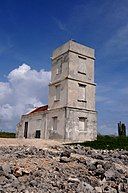 | |||
| Q29509706 | Kralendijk Lighthouse | lighthouse in Bonaire, Caribbean Netherlands | Bonaire Kralendijk |
12°08′56″N 68°16′37″W / 12.148805555556°N 68.276805555556°W 12°08′56″N 68°16′36″W / 12.148888888889°N 68.276666666667°W |
 | |||
| Q28364957 | Lacre Punt Lighthouse | lighthouse in the Netherlands | Bonaire | 12°01′41″N 68°14′17″W / 12.028°N 68.238°W | 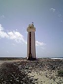 | |||
| Q29509775 | Malmok Lighthouse | lighthouse in the Netherlands | Bonaire | 12°18′41″N 68°23′32″W / 12.3113132°N 68.392268°W |  |
Delfzijl
[edit]| item | Article | description | Place | start time | end time | coordinate location | street address | image |
|---|---|---|---|---|---|---|---|---|
| Q2609558 | Delfzijl Lighthouse (1888) | lighthouse in the Netherlands | Delfzijl | 53°19′58″N 6°55′26″E / 53.332778°N 6.923889°E | ||||
| Q3970355 | Delfzijl Lighthouse (1949) | lighthouse | Delfzijl | 53°19′58″N 6°55′26″E / 53.33278°N 6.92389°E | ||||
| Q2334542 | Watum Lighthouse | lighthouse in the Netherlands | Delfzijl | 53°22′30″N 6°53′23″E / 53.374894°N 6.889736°E |  |
Enkhuizen
[edit]| item | Article | description | Place | start time | end time | coordinate location | street address | image |
|---|---|---|---|---|---|---|---|---|
| Q1180435 | De Ven | lighthouse in the Netherlands | Enkhuizen | 52°44′31″N 5°16′56″E / 52.741944°N 5.282222°E |  | |||
| Q1847968 | harbour entrance light of Enkhuizen | lighthouse in the Netherlands | Enkhuizen | 52°41′58″N 5°17′35″E / 52.699372°N 5.293064°E | nl:Tussen Twee Havens bij 1 |  |
Goeree-Overflakkee
[edit]| item | Article | description | Place | start time | end time | coordinate location | street address | image |
|---|---|---|---|---|---|---|---|---|
| Q1887871 | Toren van Goedereede | lighthouse in the Netherlands | Goeree-Overflakkee | 51°49′06″N 3°58′33″E / 51.818415450027246°N 3.97575635°E | nl:Kerkpad 3 |  | ||
| Q66882436 | Vuurtoren aan het Flaauwe Werk | lighthouse | Goeree-Overflakkee | 51°49′46″N 3°55′45″E / 51.829389°N 3.929083°E | ||||
| Q2514617 | Westhoofd Lighthouse | lighthouse in the Netherlands | Goeree-Overflakkee | 51°48′48″N 3°51′51″E / 51.813197°N 3.864133°E | nl:In de duinen bij de Groenedijk te Ouddorp |  |
Korendijk
[edit]| item | Article | description | Place | start time | end time | coordinate location | street address | image |
|---|---|---|---|---|---|---|---|---|
| Q34449521 | Nieuwendijk Range Front | lighthouse in South Holland, the Netherlands | Korendijk | 51°45′03″N 4°19′24″E / 51.750816666667°N 4.3232°E[9] | ||||
| Q34445514 | Nieuwendijk Range Rear | lighthouse in South Holland, the Netherlands | Korendijk | 51°45′11″N 4°19′04″E / 51.753066666667°N 4.3177166666667°E[9] |  |
Rotterdam
[edit]
Schiermonnikoog
[edit]| item | Article | description | Place | start time | end time | coordinate location | street address | image |
|---|---|---|---|---|---|---|---|---|
| Q748679 | North Tower | lighthouse in the Netherlands | Schiermonnikoog | 53°29′13″N 6°08′47″E / 53.486839°N 6.146525°E |  | |||
| Q228633 | Zuidertoren | lighthouse in the Netherlands | Schiermonnikoog | 53°29′00″N 6°10′00″E / 53.48333333°N 6.16666667°E |  |
Schouwen-Duiveland
[edit]| item | Article | description | Place | start time | end time | coordinate location | street address | image |
|---|---|---|---|---|---|---|---|---|
| Q66882794 | Hoge vuurtoren van Noord-Schouwen | lighthouse | Schouwen-Duiveland | 51°44′30″N 3°47′44″E / 51.741639°N 3.795417°E | ||||
| Q66882927 | Lage vuurtoren van Noord-Schouwen | lighthouse | Schouwen-Duiveland | 51°44′33″N 3°47′00″E / 51.742417°N 3.783333°E | ||||
| Q66882499 | Verklikkerlicht | lighthouse | Schouwen-Duiveland | 51°43′31″N 3°42′19″E / 51.72525°N 3.705167°E |  | |||
| Q1138126 | Westerlichttoren | lighthouse in Haamstede, Netherlands | Schouwen-Duiveland | 51°42′32″N 3°41′30″E / 51.708889°N 3.691667°E | nl:Vuurtoren 1, 4328 KG Burgh-Haamstede | 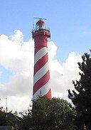 |
Súdwest-Fryslân
[edit]| item | Article | description | Place | start time | end time | coordinate location | street address | image |
|---|---|---|---|---|---|---|---|---|
| Q1143857 | Stavoren Lighthouse | lighthouse in Friesland, the Netherlands | Súdwest-Fryslân | 52°53′17″N 5°21′27″E / 52.88804°N 5.35761°E |  | |||
| Q28806370 | Stavoren North Pierhead Light | lighthouse in the Netherlands | Súdwest-Fryslân | 52°53′11″N 5°21′08″E / 52.88634°N 5.352343°E |  | |||
| Q28806369 | Stavoren South Pierhead Light | lighthouse in the Netherlands | Súdwest-Fryslân | 52°53′09″N 5°21′14″E / 52.88592°N 5.35378°E |  | |||
| Q2741100 | Workum Lighthouse | lighthouse in the Netherlands | Súdwest-Fryslân | 52°57′37″N 5°24′44″E / 52.960228°N 5.412133°E 52°57′37″N 5°24′44″E / 52.96024°N 5.4122°E |
nl:Hylperdyk 4 |  |
The Hague
[edit]| item | Article | description | Place | start time | end time | coordinate location | street address | image |
|---|---|---|---|---|---|---|---|---|
| Q2743993 | Scheveningen Lighthouse | lighthouse in the Netherlands | The Hague | 52°06′15″N 4°16′06″E / 52.104128°N 4.268244°E | nl:Zeekant 12 | 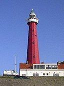 | ||
| Q28492063 | Scheveningen North Mole Light | lighthouse in the Netherlands | The Hague | 52°06′14″N 4°15′23″E / 52.10401°N 4.256322°E |  | |||
| Q34443573 | Scheveningen Pier Light | lighthouse in The Hague, the Netherlands | The Hague | 52°07′04″N 4°16′47″E / 52.117833333333°N 4.2798333333333°E[9] |  | |||
| Q28492346 | Scheveningen South Mole Light | lighthouse in the Netherlands | The Hague | 52°06′13″N 4°15′13″E / 52.1035633°N 4.253482°E | 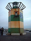 |
Veere
[edit]| item | Article | description | Place | start time | end time | coordinate location | street address | image |
|---|---|---|---|---|---|---|---|---|
| Q28470873 | Kaapduinen front lighthouse | lighthouse in the Netherlands | Veere | 51°28′28″N 3°30′59″E / 51.4745°N 3.5163333333333°E |  | |||
| Q28470871 | Kaapduinen rear lighthouse | lighthouse in the Netherlands | Veere | 51°28′24″N 3°31′08″E / 51.473233333333°N 3.5188166666667°E |  | |||
| Q2257394 | Lichtopstand Zoutelande | lighthouse in the Netherlands | Veere | 51°30′16″N 3°28′25″E / 51.50453°N 3.47351°E | 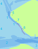 | |||
| Q1423636 | Noorderhoofd | lighthouse in the Netherlands | Veere | 51°32′24″N 3°26′12″E / 51.54°N 3.43666667°E | nl:Zeedijk 5 |  | ||
| Q1821477 | Westkapelle Hoog | lighthouse in the Netherlands | Veere | 51°31′45″N 3°26′49″E / 51.529167°N 3.446944°E | nl:Zuidstraat 1 |  |
Velsen
[edit]| item | Article | description | Place | start time | end time | coordinate location | street address | image |
|---|---|---|---|---|---|---|---|---|
| Q2972345 | Hoge vuurtoren van IJmuiden | lighthouse in the Netherlands | Velsen | 52°27′39″N 4°34′58″E / 52.460825°N 4.582806°E | nl:Vuurtorenstraat 8 |  | ||
| Q2269203 | IJmuiden lower Lighthouse | lighthouse in IJmuiden, the Netherlands | Velsen | 52°27′42″N 4°34′28″E / 52.461758°N 4.574522°E | nl:Seinpostweg 34 | 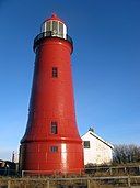 |
Voorne aan Zee
[edit]| item | Article | description | Place | start time | end time | coordinate location | street address | image |
|---|---|---|---|---|---|---|---|---|
| Q2215732 | Hellevoetsluis Lighthouse | lighthouse in the Netherlands | Voorne aan Zee | 51°49′11″N 4°07′40″E / 51.819722222222225°N 4.127777777777778°E | nl:Westkade 1, 3221AV Hellevoetsluis |  | ||
| Q17447912 | Lighthouse of Oostvoorne | lighthouse in the Netherlands | Voorne aan Zee | 51°55′07″N 4°05′42″E / 51.91862°N 4.09492°E 51°55′12″N 4°05′44″E / 51.919972°N 4.095669°E |
nl:Zwartelaan bij 1 |  | ||
| Q2577060 | Stenen Baak | lighthouse in Oostvoorne, Netherlands | Voorne aan Zee | 51°55′40″N 4°08′26″E / 51.927694444444°N 4.1406944444444°E | nl:a/d Heindijk |  |
Misc
[edit]- ^ a b "Cowles, Graham S: Papers and Correspondence". www.nhm.ac.uk. Retrieved 2023-11-06.
- ^ "NHM Archive, Sims; Reginald William (1926-2012)". www.nhm.ac.uk. Retrieved 2023-11-06.
- ^ "Harold Hall Australian expeditions", Wikipedia, 2022-06-03, retrieved 2023-11-06
- ^ British Ornithologists' Club.; Club, British Ornithologists' (1980). Bulletin of the British Ornithologists' Club. Vol. v.100 (1980). London: British Ornithologists' Club.
- ^ "Bulletin 13 - March 1981: A New Subspecies of Kingfisher". enhg.org. Retrieved 2023-11-06.
- ^ Harrison, Colin James Oliver; Cowles, G. S. (1970). Birds. Trustees of the British Museum (Natural History). ISBN 978-0-565-00561-0.
- ^ Hall, B. P.; Hall, B. P.; Expeditions, Harold Hall Australian (1974). Birds of the Harold Hall Australian Expeditions, 1962-1970 : a report on the collections made for the British Museum (Natural History). London: Trustees of the British Museum.
- ^ Hume, Julian P. (4 October 2015). "A new subfossil bulbul (Aves: Passerines: Pycnonotidae) from Rodrigues Island, Mascarenes, south-western Indian Ocean". Research Gate. Retrieved 6 Nov 2023.
- ^ a b c Online List of Lights
- ^ archINFORM
- ^ https://www.openstreetmap.org/node/4226445848


