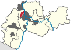
User:Bobby1011/Frankenthal1
Bobby1011/Frankenthal1 | |
|---|---|
| Coordinates: 49°32′N 8°21′E / 49.533°N 8.350°E | |
| Country | Germany |
| District | urban district |
| Government | |
| • Lord mayor | Theo Wieder (CDU) |
| Area | |
• Total | 43.78 km2 (16.90 sq mi) |
| Elevation | 96 m (315 ft) |
| Population (2006-12-31) | |
• Total | 46,938 |
| • Density | 1,100/km2 (2,800/sq mi) |
| Time zone | UTC+01:00 (CET) |
| • Summer (DST) | UTC+02:00 (CEST) |
| Postal codes | 67227 |
| Dialling codes | 06233 |
| Vehicle registration | FT |
| Website | frankenthal.de |
Frankenthal is a city in southwestern Germany, in the state of Rheinland-Pfalz.
History
[edit]Frankenthal was first mentioned in D.C 772. In 1119 an Augustinian monastery was built here, the ruins of which - known, after the founder, as the Erkenbertsruine - still stand today in the town centre.
In the second half of the 16th century, people from the Netherlands, persecuted for their religious beliefs, settled in Frankenthal. They were industrious and artistic and brought economic prosperity to the town. Some of them were important carpet weavers, jewellers and artists whose "Frankenthaler Malerschule" (Frankenthal school of painting) acquired some fame. In 1577 the settlement was raised to the status of a town by the Count Palatine Johann Casimir.
In 1600 Frankenthal was converted to a fortress. In 1621 it was besieged by the Spanish during the Thirty Years' War, and then successively occupied by troops of the opposing sides. Trade and industry were ruined and the town was not reconstructed until 1682.
In 1689 the town was burnt to the ground by French troops in the war of the Palatinate and Orleans. The town did not fully recover from this for more than fifty years.
However, in 1750, under the rule of the Elector (Kurfürst) Karl Theodor, Frankenthal was established as a centre of industry. Numerous factories were opened and mulberry trees were planted for silk production. In 1755 the famous Frankenthal porcelain factory was opened, which remained in production until 1800.
In 1797 the town came under French occupation. It passed into the rule of Bavaria in 1816.
The beginning of modern industrialisation is dated from 1859.
In 1938 the Jewish synagogue, built in 1884, was burnt to the ground during the Kristallnacht.
In 1943 during a bombing raid the centre of the town was almost completely destroyed. In 1945, at the end of the war, its industries in ruins, it was occupied first by the Americans and then by the French.
From 1946 Frankenthal has been part of the federal state of Rhineland-Palatinate. Today the town is again the site of some medium sized industries.
Twin towns
[edit] Colombes, France since October 26th, 1958
 Strausberg, Germany (Brandenburg) since October 16th, 1990
 Sopot, Poland since April 17th, 1991
Partnerschaftliche Beziehungen:
Associated towns:
Gallery
[edit]-
ruins of the monastery
-
churches
-
Wormser Tor
-
outskirts
Category:Cities in Rhineland-Palatinate Category:Towns in Rhineland-Palatinate


