Tuctubamba
Appearance
| Tuctubamba | |
|---|---|
 Tuctubamba as seen from below Punta Unión | |
| Highest point | |
| Elevation | 5,240 m (17,190 ft) |
| Coordinates | 8°54′12″S 77°33′30″W / 8.90333°S 77.55833°W |
| Geography | |
| Location | Peru, Ancash Region |
| Parent range | Andes, Cordillera Blanca |
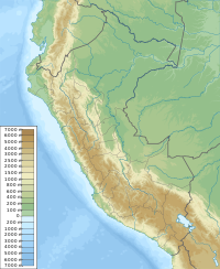
Tuctubamba[1][2] or Tuqtubamba[3] (possibly from Quechua tuqtu broody hen, pampa a large plain,[4] "broody hen plain") is a 5,240-metre-high (17,192 ft)[3][5] mountain in the Cordillera Blanca in the Andes of Peru.[5] It is situated in the Ancash Region, at the border of the Mariscal Luzuriaga Province, Lucma District, the Pomabamba Province, Huayllán District, and the Yungay Province, Yanama District.[2] Tuctubamba lies southeast of Taulliraju.[2][6]
See also
[edit]References
[edit]- ^ Peru 1:100 000, Corongo (18-h). IGN (Instituto Geográfico Nacional - Perú).
- ^ a b c escale.minedu.gob.pe - UGEL map of the Huaylas Province 2 (Ancash Region)
- ^ a b Ricker, John (1977). Yuraq Janka: A Guide to the Peruvian Andes. The Mountaineers Books. p. 69.
- ^ Teofilo Laime Ajacopa (2007). Diccionario Bilingüe: Iskay simipi yuyayk’anch: Quechua – Castellano / Castellano – Quechua (PDF). La Paz, Bolivia: futatraw.ourproject.org.
- ^ a b Alpenvereinskarte 0/3a. Cordillera Blanca Nord (Peru). 1:100 000. Oesterreichischer Alpenverein. 2005. ISBN 3-928777-57-2.
- ^ "Andes. Perú. Cordillera Blanca. Errores u omisiones. El Taulliraju Sur confundido con el Tuctubamba. Parte I". Andes Info. Retrieved January 29, 2015.

