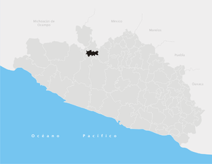
Tlapehuala (municipality)
Appearance
Tlapehuala | |
|---|---|
 Municipality of San Luis Acatlán in Guerrero | |
| Coordinates: 18°13′N 100°17′W / 18.217°N 100.283°W | |
| Country | |
| State | Guerrero |
| Municipal seat | Tlapehuala |
| Area | |
• Total | 266.7 km2 (103.0 sq mi) |
| Population (2005) | |
• Total | 20,989 |
Tlapehuala is a municipality in the Mexican state of Guerrero. The municipal seat lies at Tlapehuala. The municipality covers an area of 266.7 km2.
As of 2005, the municipality had a total population of 20,989.[1]
History
[edit]Former mayor Aurelio Santamaría Bahena (MORENA), died on February 5, 2021, due to the COVID-19 pandemic in Mexico.[2] As of February 18, there were 191 cases and 21 deaths in the municipality due to the pandemic.[3]
References
[edit]- ^ "Tlapehuala". Enciclopedia de los Municipios de México. Instituto Nacional para el Federalismo y el Desarrollo Municipal. Archived from the original on March 7, 2007. Retrieved December 23, 2008.
- ^ Muere por covid-19 ex alcalde de Tlapehuala, Guerrero (Milenio, 5 Feb 2021, retrieved 19 Feb 2021)
- ^ "Coronavirus (COVID-19) en Tlapehuala, Guerrero". gncys.com (in Mexican Spanish). 1 February 2020. Retrieved February 19, 2021.

