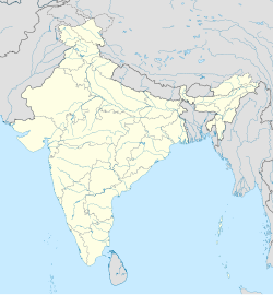
Thungapuram
Appearance
This article possibly contains original research. (August 2019) |
Thungapuram | |
|---|---|
Panchayat village | |
 | |
| Coordinates: 11°11′N 79°06′E / 11.19°N 79.10°E | |
| Country | |
| State | Tamil Nadu |
| District | Perambalur |
| Languages | |
| • Official | Tamil |
| Time zone | UTC+5:30 (IST) |
| PIN | 621 716.[1] |
| Telephone code | 04328 |
| Vehicle registration | TN46, TN45 |
| Nearest city | Perambalur, Ariyalur, Thittakudi, Trichy. |
| Literacy | 72% |
| Climate | cool- hat-cool (Köppen) |
| Website | wikimapia |
Thungapuram (Tunkapuram or Kulōttuŋkacōļapuram or Ciṛu Maturai) is a panchayat village of Perambalur district, Tamil Nadu, India. It was formerly in Tiruchirappalli district
Politics
[edit]Before in 1995 Thungapuram have under Perambalur taluk and Tiruchirappalli district. After Composite Perambalur District came into existence after trifurcation of Tiruchirappalli district with effect from 30.09.1995 as per G.O MS.No 913 Revenue / Y3 dated 30.09.1995. Now its comes to under kunnam taluk in Perambalur district.
Thungapuram assembly constituency is part of Chidambaram (Lok Sabha constituency).[2]
Media and communication
[edit]Leading Tamil, English languages newspapers are available in Thungapuram. English dailies such as, The New Indian Express, The Hindu [3] are available.
External links
[edit]- Ariyalur District Official WebSite
- Perambalur District Official WebSite
- Trichy District Official WebSite
References
[edit]- ^ "Ariyalur - district sendurai - taluk ham let villages and postoffice" (PDF). Tamil Nadu. Government of Tamil Nadu. Archived from the original (PDF) on 5 October 2011.
- ^ "List of Parliamentary and Assembly Constituencies" (PDF). Tamil Nadu. Election Commission of India. Archived from the original (PDF) on 4 March 2009. Retrieved 11 October 2008.
- ^ "The toppers in SSLC exams among the government schools in perambalur district". The Hindu. thehindu.com. 6 June 2012.


