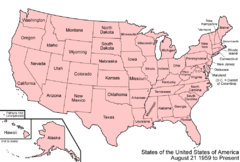
Territorial evolution of Arizona
Appearance


The following timeline traces the territorial evolution of the U.S. State of Arizona.
Timeline
[edit]- Historical territorial claims of Spain in the present State of Arizona:
- Nueva Vizcaya, 1562–1821
- Santa Fé de Nuevo Méjico, 1598–1821
- Sonora y Sinaloa, 1732–1821
- Treaty of Córdoba of 1821
- Historical territorial claims of Mexico in the present State of Arizona:
- Santa Fé de Nuevo México, 1821–1848
- Sonora y Sinaloa (Estado de Occidente), 1824–1830
- Sonora since 1830
- Treaty of Guadalupe Hidalgo of 1848
- Gadsden Purchase of 1853
- Historical political divisions of the United States in the present State of Arizona:
- Unorganized territory created by the Treaty of Guadalupe Hidalgo, 1848–1850
- State of Deseret (extralegal), 1849–1850
- Territory of New Mexico, 1850–1912
- Gadsden Purchase of 1853
- American Civil War, 1861–1865
- Arizona Territory (CSA), 1861–1865
- Territory of Arizona, 1863–1912[1]
- North-western corner of the Arizona Territory is transferred to the State of Nevada, 1867
- State of Arizona since February 14, 1912
- Mexican Boundary Exchanges: In 1927 under the Banco Convention of 1905, the U.S. acquired two bancos from Mexico at the Colorado River border with Arizona. Farmers Banco, covering 583.4 acres (2.361 km2), a part of the Cocopah Indian Reservation at 32°37′27″N 114°46′45″W / 32.62417°N 114.77917°W, was ceded to the U.S. with controversy.[2] Fain Banco (259 acres (1.05 km2)) at 32°31′32″N 114°47′28″W / 32.52556°N 114.79111°W also became U.S. soil.
See also
[edit] Territorial evolution of California
 List of territorial claims and designations in Colorado
 Territorial evolution of Nevada
 Territorial evolution of New Mexico
 Territorial evolution of Utah
References
[edit]- ^ Thirty-seventh United States Congress (February 24, 1863). "An Act to provide a temporary Government for the Territory of Arizona, and for other Purposes". Retrieved June 5, 2009.
- ^ Decisions of the Department of the Interior in cases relating to the public lands: 1927–1954. United States. Department of the Interior. Washington. For sale by the Supt. of Docs., U.S. Govt. Print. Off. pp. 25, 337. hdl:2027/mdp.39015084910804.
