Template:POTD/2011-07-24
Appearance
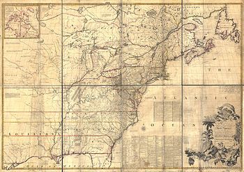
The Mitchell Map is the most comprehensive map of eastern North America made during the colonial era. Measuring about 6.5 ft (2.0 m) wide by 4.5 ft (1.4 m) high, it was produced by John Mitchell in 1757 in eight separate sheets. The map was used during the Treaty of Paris for defining the boundaries of the United States, and remains important today for resolving border disputes.Author: John Mitchell; scan: Library of Congress, Geography and Map Division.
| This picture of the day has been featured on Portal:Geography. |

