Taguayabón
Taguayabón | |
|---|---|
Village | |
 The Circuito Norte in Taguayabon | |
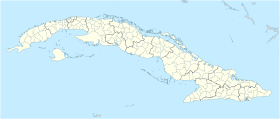
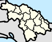
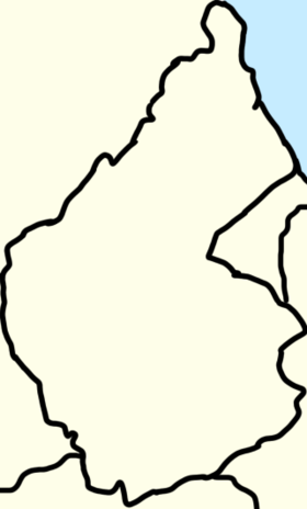
 Map of Taguayabón (Red) in Camajuaní (Orange) in Villa Clara (Yellow) | |
| Coordinates: 22°28′39.8″N 79°39′01.2″W / 22.477722°N 79.650333°W | |
| Country | Cuba |
| Province | Villa Clara |
| Municipality | Camajuaní |
| Founded | 1830[1] |
| Elevation | 80 m (260 ft) |
| Population (2012)[2] | |
• Total | 2,053 |
| Time zone | UTC-5 (EST) |
| Area code | +53-422 |
Taguayabón is a Cuban village and consejo popular (ward) of the municipality of Camajuaní, in Villa Clara Province. In 2012 it had a population of 2053.[3]
History
[edit]
The village, whose name means "butterfly village" in Taíno language,[citation needed] has an unknown foundation date, being made before the Spanish discovered the town.[4] Until 1976, it was a barrio of the former municipality of San Antonio de las Vueltas (or Vueltas), merged in Camajuaní.[1]
Geography
[edit]Located on a rural plain surrounded by scattered hills, between Camajuaní (7.7 km west) and Remedios (11 km east); Taguayabón spans on two main crossroads, being the Calle Rivadeneira (N-S) and the Circuito Norte (W-E).[5][4] Nearest places are the villages of Palenque (3 km east), Entronque de Vueltas (3 km west) and Vega de Palma (5 km west). The village is 9 km from Vueltas, 20 from Caibarién, 26 from Placetas, 34 from Santa Clara and 80 from Cayo Santa María.
The local government area of the "Consejo Popular de Taguayabón" includes the villages of Carolina,[6] Corea, La Julia, Las Lechugas, Lobatón, Rosalía, CCS Fidel Claro,[7] and Palenque.[citation needed]
Government
[edit]Camajuaní has multiple Constituency Delegate (Delegado Circunscripción) for every ward, Taguayabón’s ward has:[8]
- Constituency Delegate #63 Javier Morffi Pérez
- Constituency Delegate #71 Rafael Gómez Morales
- Constituency Delegate #72 Rafael Gómez Morales
- Constituency Delegate #73 José A. Hernández Gómez
- Constituency Delegate #75 Roberto Cruz Ramos
Transport
[edit]Taguayabón is crossed in the middle by the state highway "Circuito Norte" (CN) and counts a railway station on the line Santa Clara-Camajuaní-Remedios-Caibarién.[9] Nearest airport, the "Abel Santamaría" of Santa Clara (IATA: SNU), is 30 km west.
Economy
[edit]According at the DMPF (Departamento de control de la Dirección Municipal de Planificación Física or Management Control Department Municipal Physical Planning in English) of Camajuani, Taguayabón is a settlement linked to sources of employment or economic development.[10]
The Provincial Tobacco Company La Estrella has territory in La Quinta, Camajuani, Aguada de Moya, San Antonio de las Vueltas, and Taguayabón.[11]
In order to make charcoal in Camajuani you need to live in Luis Arcos Bergnes or Taguayabón.[12]
Taguayabón gets most of its products from CPA "13 de Marzo",[13] which is located in the ward. [14]
Education
[edit]There are a few schools in the ward of Taguayabón, these include:[15]
- Pelayo Cuervo Primary
- ESBU Clemente Cárdenas Ávila Secondary
Infrastructure
[edit]In La Quinta, Taguayabón, San Antonio de las Vueltas, and Vega de Palma there are a combined total of 13 Municipal Collection Establishment squares.[11]
See also
[edit]References
[edit]- ^ a b San Antonio de las Vueltas municipality (including Taguayabón) on guije.com
- ^ "Camajuaní (Municipality, Villa Clara Province, Cuba) - Population Statistics, Charts, Map and Location".
- ^ "Camajuaní (Municipality, Villa Clara Province, Cuba) - Population Statistics, Charts, Map and Location". citypopulation.de. Retrieved 2022-07-02.
- ^ a b Barroso, Mario Félix Lleonart (2015-06-30). "Taguayabón y el conjuro de la gitana". 14ymedio (in Spanish). Retrieved 2024-08-31.
- ^ 4320533257 Taguayabón on OpenStreetMap
- ^ Ruiz, Asdrubal Martínez; Cala, Yerenis Torres; Jiménez, Osvaldo López (2023-11-09). "Plan de acciones para contrarrestar los impactos del cambio climático en zonas vulnerables en Camajuaní". Cub@: Medio Ambiente y Desarrollo (in Spanish). 23. ISSN 1683-8904.
- ^ "Celebrado en Villa Clara acto de Cuba por el Día Internacional de la Mujer Rural". mapeo.onu.org.cu. Retrieved 2023-04-13.
- ^ "Portal del Ciudadano en Camajuaní - Consejo Popular Taguayabón". www.soycamajuani.gob.cu. Retrieved 2022-12-24.
- ^ 4729970437 Taguayabón railway station on OpenStreetMap
- ^ Barroso, Joel Jiménez; Figueroa Vidal, Dr. Arq. Carlos. R. "Diagnóstico estratégico de la situación habitacional del municipio de Camajuaní" (PDF). p. 67.
- ^ a b Nacional, Equipo de Producción. "Portal del Ciudadano en Camajuaní - Agricultura". Portal del Ciudadano en Camajuaní (in European Spanish). Retrieved 2022-12-31.
- ^ "Empleo". Portal del Ciudadano en Camajuaní (in European Spanish). Retrieved 2022-12-31.
- ^ Vanguardia, Tomado de. "Villa_Clara - Embajador de Japón en Cuba recorre pequeñas industrias de Villa Clara (+Fotos y Videos)". Villa_Clara. Retrieved 2023-04-14.
- ^ Hekademus - Revista Cientifica de la FIEE. Volumen 02. Numero 06 (in Spanish). Julio Cesar Antolin Larios.
- ^ "Portal del Ciudadano en Camajuaní - Educación". www.soycamajuani.gob.cu. Retrieved 2022-12-23.
External links
[edit]- Taguayabón Weather on accuweather.com


