Square Butte (Montana)
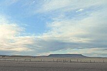
Square Butte is a name used for 11 buttes in Montana. Two of the most prominent buttes are located in a) Cascade County, Montana, about 22 miles (35 km) due west of Great Falls and in b) Chouteau County, Montana, about 50 miles (80 km) due east of Great Falls and about 15 miles (24 km) due east of the Highwood Mountains. Charles Marion Russell, the noted Montana western artist used both features as background in his paintings of Montana.
Square Butte in Cascade County
[edit]
Square Butte in Cascade County, Montana, 47°26′30″N 111°44′50″W / 47.44167°N 111.74722°W[1] is located about 22 miles (35 km) due west of Great Falls, Montana. The highest elevation of the Cascade County Square Butte is 4,728 feet (1,441 m)[1]
Square Butte is easily visible for many miles around. It is a prominent feature on the northern skyline as a motorist travels along Interstate 15, west of Great Falls in the vicinity of mile marker 264. It is also visible on the southern skyline while traveling on Montana Highway 200 in the vicinity of Sun River and Fort Shaw.[2] To the west of Square Butte is another topographic feature, Crown Butte.
Lewis and Clark Pass crosses the continental divide at the crest of the Northern Rocky Mountains which lie to the west of the Cascade County Square Butte. From that pass on July 7, 1806 the explorer Meriwether Lewis (of the Lewis and Clark Expedition, 1803-1806) returning eastward from his journey to the mouth of the Columbia River and the Pacific Ocean, saw Square Butte on the skyline of the eastern Montana prairie stating in his journal:
"2 m. passing the dividing ridge between the waters of the Columbia and Missouri rivers at 1/4 of a mile [Lewis and Clark Pass]. from this gap which is low and an easy ascent on the W. side, the fort mountain [Square Butte] bears North Eaast, and appears to be distant about 20 miles."[3]
From that pass on a clear day, the Cascade County Square Butte can still be seen, not at the 20 miles reported by Meriwether Lewis but about 40 miles (64 km) out in the eastern Montana grasslands.
Square Butte in Chouteau County
[edit]

Square Butte in Chouteau County, Montana, 47°30′54″N 110°11′54″W / 47.51500°N 110.19833°W[4] is located about 50 miles (80 km) due east of the city of Great Falls, Montana, and about 15 miles (24 km) due east of the center of the Highwood Mountains. The highest elevation of the Chouteau County Square Butte is 5,732 feet (1,747 m).[4]
Square Butte also forms a unique and easily visible landmark on the horizon. It is visible from Montana Highway 3 between Geyser and Stanford, Montana. It is also visible from Montana Highway 80 between Stanford and Geraldine, Montana, which passes just to the east of the butte.[2] The small almost dormant town of Square Butte, Montana lies just at the base of the Chouteau County butte, on Montana Highway 80. About 4 miles (6.4 km) to the west of Square Butte is a smaller feature, Round Butte.
Featured in paintings of C. M. Russell
[edit]
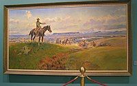
Charles Marion Russell, the noted western Artist, utilized both features as background in his paintings. The well known painting, "Charles M. Russell and His Friends" has the Cascade County Square Butte in the background. For a view of that painting showing the butte, click on the footnoted source.[5] As an example of the placement of the Chouteau County Square Butte in a Russell painting see "The Tenderfoot", which has the more compact Chouteau County Square Butte in the background. For a view of that painting showing the butte, click on the footnoted source.[6]
Additional buttes
[edit]- Square Butte, Daniels County, Montana, el. 2,897 feet (883 m), 48°55′47″N 105°15′02″W / 48.92972°N 105.25056°W[7]
- Square Butte, Garfield County, Montana, el. 3,058 feet (932 m), 47°21′56″N 107°36′07″W / 47.36556°N 107.60194°W[8]
- Square Butte, Garfield County, Montana, el. 2,831 feet (863 m), 47°42′24″N 106°30′12″W / 47.70667°N 106.50333°W[9]
- Square Butte, Glacier County, Montana, el. 4,570 feet (1,390 m), 48°44′43″N 112°49′17″W / 48.74528°N 112.82139°W[10]
- Square Butte, Hill County, Montana, el. 3,625 feet (1,105 m), 48°19′46″N 109°55′30″W / 48.32944°N 109.92500°W[11]
- Square Butte, Musselshell County, Montana, el. 4,528 feet (1,380 m), 46°18′36″N 108°13′10″W / 46.31000°N 108.21944°W[12]
- Square Butte, Phillips County, Montana, el. 2,933 feet (894 m), 47°46′21″N 107°35′41″W / 47.77250°N 107.59472°W[13]
- Square Butte, Roosevelt County, Montana, el. 2,572 feet (784 m), 48°30′47″N 105°13′21″W / 48.51306°N 105.22250°W[14]
- Square Butte, Stillwater County, Montana, el. 3,773 feet (1,150 m), 45°39′47″N 108°53′28″W / 45.66306°N 108.89111°W[15]
See also
[edit]References
[edit]- ^ a b "Square Butte". Geographic Names Information System. United States Geological Survey, United States Department of the Interior.
- ^ a b Highway views of this Square Butte may be observed by utilizing the "Street View" feature of Google Earth, from vantage points on the described highway.
- ^ Lewis, Merriwether. "The Journals of the Lewis and Clark Expedition". The Journals of the Lewis and Clark Expedition. University of Nebraska Press. Retrieved 28 November 2015.
- ^ a b "Square Butte". Geographic Names Information System. United States Geological Survey, United States Department of the Interior.
- ^ "Charles M. Russell and His Friends - Reproduction - www.charlesmarionrussell.org - Large". Archived from the original on 2014-11-05. Retrieved 2024-12-20.
- ^ "The Tenderfoot - Charles Marion Russell - Charles Marion Russell". Archived from the original on 2010-01-16. Retrieved 2024-12-20.
- ^ "Square Butte". Geographic Names Information System. United States Geological Survey, United States Department of the Interior.
- ^ "Square Butte". Geographic Names Information System. United States Geological Survey, United States Department of the Interior.
- ^ "Square Butte". Geographic Names Information System. United States Geological Survey, United States Department of the Interior.
- ^ "Square Butte". Geographic Names Information System. United States Geological Survey, United States Department of the Interior.
- ^ "Square Butte". Geographic Names Information System. United States Geological Survey, United States Department of the Interior.
- ^ "Square Butte". Geographic Names Information System. United States Geological Survey, United States Department of the Interior.
- ^ "Square Butte". Geographic Names Information System. United States Geological Survey, United States Department of the Interior.
- ^ "Square Butte". Geographic Names Information System. United States Geological Survey, United States Department of the Interior.
- ^ "Square Butte". Geographic Names Information System. United States Geological Survey, United States Department of the Interior.


