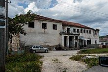
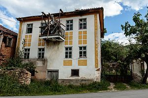
Sloeštica
Sloeštica
Слоештица | |
|---|---|
Village | |
 Community center in the village Sloeštica | |
 | |
| Coordinates: 41°16′0″N 21°4′36″E / 41.26667°N 21.07667°E | |
| Country | |
| Region | |
| Municipality | |
| Area | |
• Total | 21.4 km2 (8.3 sq mi) |
| Elevation | 770 m (2,530 ft) |
| Population (2002) | |
• Total | 221[1] |
| Time zone | UTC+1 (CET) |
| • Summer (DST) | UTC+2 (CEST) |
| Postal code | 7240 |
| Area code | +389 047 |
| Car plates | DH |
| Website | [1] |
Sloeštica (Macedonian Слоештица) is a small village in the municipality of Demir Hisar, in the area of Zeleznik, in the vicinity of the town of Demir Hisar. It used to be part of the former municipality of Sopotnica.
Geography
[edit]
The village is located in the southwest part of the Municipality of Demir Hisar, on the right side of Crna River. The village is hilly, at an altitude of 770 meters.[2] It is 50 km (northwest) away from the nearest major city, Bitola.
The area around the village occupies an area of 21.4 km2, with forests covering an area of 1,511 hectares, with arable land of 330 hectares, and 269 hectares of pastures.[2]
The climate in the settlement is mountainous. It is bordered easterly by the Plakenska Mountain. There are two rivers running through the village: Bela Reka (Golemacha) and Levacha.
History
[edit]During the Ilinden Uprising, the village was attacked on August 18, 1903 by Turkish forces. Villagers Bogoya Ivanov, Nikola Talev and Stoycho Ristev were killed from the village, and Mets Stoyanov and Dole Ristev from Slepche died as chetas near the village.[3]
In October 1910 the village suffered during the disarmament action of the young Turks. A Bulgarian teacher in the village, Doychinov was arrested and jailed in the village of Pribilci.[4]
Population
[edit]According to Vasil Kanchov in his Macedonia Ethnography and Statistics from 1900, there were 650 inhabitants in the village of Sloeshtica, in 90 houses, all Bulgarians.[5] Following this, the secretary of the Bulgarian Exarchate, Dimitar Mishev, recorded in his book La Macédoine et sa Population Chrétienne a population of 720 inhabitants in 1905.[6]
During the second half of the 20th century, a number of the population moved from Sloeshtica, going from a medium to a small village. In 1961 the village had 746 inhabitants, and in 1994, 299 inhabitants.[7]
According to the last census of 2002, 221 inhabitants lived in the village, all Macedonians.[1]
| Year | Pop. | ±% |
|---|---|---|
| 1900 | 650 | — |
| 1905 | 720 | +10.8% |
| 1948 | 878 | +21.9% |
| 1953 | 841 | −4.2% |
| 1961 | 746 | −11.3% |
| 1971 | 621 | −16.8% |
| 1981 | 535 | −13.8% |
| 1991 | 312 | −41.7% |
| 1994 | 299 | −4.2% |
| 2002 | 221 | −26.1% |
| Source: Source for 1948-2002 State Statistical Office of North Macedonia .[8] | ||
Research on historical families
[edit]According to the research of Branislav Rusic in 1952, the genealogy of the village includes the following family names:[9]
- Family names with an unknown origin or name: Domazetovci (2 k.), Kaychovci (7 k.), Korunovci (2 k.), Kuzevci (2 k.), Dzhaykovci (4 k.), Jankulovci (5 k.), Bogevci (2 k.), Sivevci and Plevnesovci (21 k.), Despotovci (2 k.), Petkovci (5 k.), Petrevci (5 k.), Gjorgovtsi Mitrevci (8 k.), Meglenovci (8 k.), Kaparkovci (13 k.), Gyurkovci (2 k.), Bojanovci (1 k.) And Nochevci (6 k.)
- Family names with a known age: Popovci (11 k.) settled from the village Babino; Ilijevci (1 k.) settled from the village of Cerovo; Poljankovci (1 k.) settled from the village of Suvo Selo; Trajanovci (7 k.) settled from the village of Galičnik in Mijaks region; Svrgovci (4 k.) settled from the village of Bazernik; Evenovci (2 k.) settled from the village of Sladuevo; Trenchevci (2 k.) settled from the village of Jankovec. Finally there is Alekso (living at the age of 45 in 1952), Tale-Stojko-Trenche.
Social facilities
[edit]There is a single primary school, known as Braka Miladinovci, named after the Miladinov brothers. It teaches up to the 5th grade.[10]
Cultural and natural landmarks
[edit]
- Archaeological sites:
- The turn - settlement from Late Antiquity.[11]

- Churches:[12]
- Church "St. Mother of God " - the main village church (post Byzantian)
- Church "St. Atanasij " - the cemetery village church (post Byzantian)
- Church "St. Gorgi " - a monastery church
- Church "St. Ilija "
- Church "St. Nikola " - monastery church of the Toplice monastery
- Valavici (artificial waterfall)
- Near the village there are waterfalls, artificially built and used in washing and cleaning clothing and blankets.[13]
Cultural events
[edit]Every year on August 28, there is the "Celebration of the Pirejot", held in memory of the writer Petre M. Andreevski.[14][15]
Notable individuals
[edit]- Elijah Dimovski, leader of the detachment from Sloeštica during the Ilinden-Preobrazhenie uprising in 1903[16]
- Jordan Plevnes - writer
- Stoyan Acev - Macedonian-Adrianople Corps [17]
- Petre M Andreevski - writer
References
[edit]- ^ a b http://www.stat.gov.mk/Publikacii/knigaX.pdf Census on Macedonia, 2002, Access date: 3 December 2016
- ^ a b Panov, Mitko (1998) (in Macedonian). Encyclopedia of the villages in the Republic of Macedonia . Skopje: Patria. p. 202-203 . visit. Dekemvri 2016 g 3. https://commons.wikimedia.org/wiki/File:%D0%95%D0%BD%D1%86%D0%B8%D0%BA%D0%BB%D0%BE%D0%BF%D0%B5%D0%B4%D0%B8%D1%98%D0%B0_%D0%BD%D0%B0_%D1%81%D0%B5%D0%BB%D0%B0%D1%82%D0%B0_%D0%B2%D0%BE_%D0%A0%D0%B5%D0%BF%D1%83%D0%B1%D0%BB%D0%B8%D0%BA%D0%B0_%D0%9C%D0%B0%D0%BA%D0%B5%D0%B4%D0%BE%D0%BD%D0%B8%D1%98%D0%B0.pdf
- ^ Ilinden Illustration, No. 147, p.15
- ^ Debarski voice, year 2, issue 28, 7 November 1910, p. 4.
- ^ Васил К’нчов. „Македонија. Етнографија и статистика“. Софија, 1900, стр. 240.
- ^ D.M.Brancoff. "La Macédoine et sa Population Chrétienne". Paris, 1905, р.172-173.
- ^ "Ќе Се Чисти Црна Река".
- ^ "Population by age and sex, by settlement, according to censuses conducted in the Republic of Macedonia after World War II" . State Statistical Office .
- ^ Archive MANU Fund "Branislav Rusic" AE 97 / 1b "Zeleznik" Sloeshtica.
- ^ "Primary education" . Macedonian: Municipality of Demir Hisar . cons. July 26, 2016 .
- ^ Kotzo, Dimche (1996). "Archaeological map of the Republic of Macedonia". Skopje: MANU. ISBN 9789989101069
- ^ Jelena Pavlovska, Natasha Nificorovic and Ognen Kocevski (2011). Valentina Bozhinovska. device (in Macedonian). Map of religious buildings in Macedonia . Menora - Skopje: Commission for Relations in Religious Communities and Religious Groups. ISBN 978-608-65143-2-7 .
- ^ "Мој Роден Крај".
- ^ Alexander Mateski, "Plakenska Planina", Economics and Business, 18, No. 219, September 2016, p. 106-107.
- ^ "Celebration of the Piraeus "in Sloeshtica ", " Nova Makedonija ", August 27, 2012 (opener, June 26, 2013 ).
- ^ Nikolov, Boris Y. Inner Macedonian-Odrin revolutionary organization. Vojvodov and leaders (1893-1934). Bibliographic Bibliographic Guide, Sofia, 2001, p. 49.
- ^ Macedonian-Adrianople Corps 1912-1913 Staff, Chief Administration of Archives, 2006, p. 74.

