Shwebo District
Appearance
Shwebo District | |
|---|---|
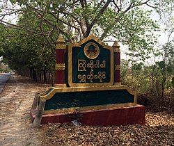
 Shwebo District signboard located on Sagaing-Shwebo road | |
 | |
| Country | |
| Region | Sagaing Region |
| No. of Townships | 6 |
| Capital | Shwebo |
| Time zone | UTC+6.30 (MST) |
Shwebo District is a district in south-central Sagaing Division of Burma (Myanmar).[1] Its administrative center is the city of Shwebo.
Townships
[edit]
Shwebo
Khin-U
Tabayin
Taze
Wetlet
Ye-U
The district consists of the following townships:
- Khin-U Township
- Shwebo Township
- Wetlet Township
- Taze Township
- Ye-U Township
- Tabayin Township (formerly from Monywa District)
Shwebo District also consisted of the following townships, which formed to become Kanbalu District:
Economy
[edit]The area is supported by rice farming, fisheries and timbering.
Notes
[edit]- ^ "Burma: Second-Order Administrative Divisions (Districts)" The Permanent Committee of Geographic Names (PCGN), United Kingdom, from Internet Archive
23°12′N 95°31′E / 23.200°N 95.517°E


