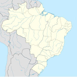
Sertânia
Appearance
Sertânia | |
|---|---|
| Coordinates: 8°4′14″S 37°15′57″W / 8.07056°S 37.26583°W | |
| Country | |
| Region | Northeast |
| State | |
| Government | |
| • Mayor | Gustavo Maciel Lins de Albuquerque |
| Area | |
• Total | 2,421,511 km2 (934,951 sq mi) |
| Elevation | 558 m (1,831 ft) |
| Population (2020 [1]) | |
• Total | 36,050 |
| • Density | 13.95/km2 (36.1/sq mi) |
| Time zone | UTC−3 (BRT) |
| Area code | +55 81 |
Sertânia is a city in the state of Pernambuco, Brazil. The population in 2020, according to the IBGE, was 36,050. Its total area is 2421.51 km2.
Geography
[edit]- State - Pernambuco
- Region - Sertão Pernambucano
- Boundaries - Iguaraci and Paraíba state (N); Arcoverde, Buíque, Ibimirim and Tupanatinga (S); Custódia (W); Paraíba (E)
- Area - 2421.51 km²
- Elevation - 558 m
- Hydrography - Moxotó River
- Vegetation - Caatinga Hiperxerófila
- Climate - semi-arid, hot and dry
- Annual average temperature - 23.7 c
- Distance to Recife - 309 km
Economy
[edit]The main economic activities in Sertânia are based in industry, commerce and agribusiness, especially the raising of cattle, sheep (over 85,000), pigs, goats (over 120,000), horses, and donkeys; and plantations of corn, tomatoes and beans.
Economic indicators
[edit]| Population | GDP x(1000 R$).[2] | GDP pc (R$) | PE |
|---|---|---|---|
| 35.914 | 114.212 | 3.352 | 0.19% |
Economy by sector 2006
| Primary sector | Secondary sector | Service sector |
|---|---|---|
| 13.63% | 10.81% | 75.56% |
Health indicators
[edit]| HDI (2000) | Hospitals (2007) | Hospitals beds (2007) | Children's mortality every 1000 (2005) |
|---|---|---|---|
| 0.648 | 2 | 109 | 31.6 |
See also
[edit]References
[edit]


