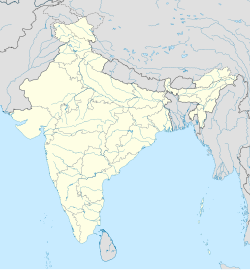
Semri Kalan
Appearance
Semri Kalan | |
|---|---|
village | |
| Coordinates: 23°07′18″N 77°25′53″E / 23.1218049°N 77.4314703°E | |
| Country | India |
| State | Madhya Pradesh |
| District | Bhopal |
| Tehsil | Berasia |
| Elevation | 462 m (1,516 ft) |
| Population (2011) | |
• Total | 1,044 |
| Time zone | UTC+5:30 (IST) |
| ISO 3166 code | MP-IN |
| 2011 census code | 482279 |
Semri Kalan is a village in the Bhopal district of Madhya Pradesh, India. It is located in the Berasia tehsil.[1]
Demographics
[edit]According to the 2011 census of India, Semri Kalan has 243 households. The effective literacy rate (i.e. the literacy rate of population excluding children aged 6 and below) is 79.58%.[2]
| Total | Male | Female | |
|---|---|---|---|
| Population | 1044 | 556 | 488 |
| Children aged below 6 years | 148 | 80 | 68 |
| Scheduled caste | 346 | 184 | 162 |
| Scheduled tribe | 1 | 1 | 0 |
| Literates | 713 | 439 | 274 |
| Workers (all) | 384 | 279 | 105 |
| Main workers (total) | 148 | 140 | 8 |
| Main workers: Cultivators | 114 | 108 | 6 |
| Main workers: Agricultural labourers | 16 | 15 | 1 |
| Main workers: Household industry workers | 2 | 2 | 0 |
| Main workers: Other | 16 | 15 | 1 |
| Marginal workers (total) | 236 | 139 | 97 |
| Marginal workers: Cultivators | 23 | 15 | 8 |
| Marginal workers: Agricultural labourers | 191 | 111 | 80 |
| Marginal workers: Household industry workers | 11 | 5 | 6 |
| Marginal workers: Others | 11 | 8 | 3 |
| Non-workers | 660 | 277 | 383 |
References
[edit]- ^ Lok Seva Kendra, Berasia
- ^ a b "District Census Handbook - Bhopal" (PDF). 2011 Census of India. Directorate of Census Operations, Madhya Pradesh. Retrieved 20 July 2015.


