Scheerwolde
Appearance
Scheerwolde | |
|---|---|
Village | |
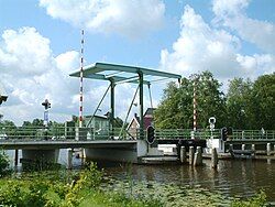
 The Scheerebrug near Scheerwolde | |
| Coordinates: 52°45′23″N 6°00′53″E / 52.75627°N 6.01472°E | |
| Country | |
| Province | |
| Municipality | |
| Area | |
• Total | 17.07 km2 (6.59 sq mi) |
| • Land | 16.53 km2 (6.38 sq mi) |
| • Water | 0.54 km2 (0.21 sq mi) |
| Elevation | −1.2 m (−3.9 ft) |
| Population (2023)[1] | |
• Total | 620 |
| • Density | 36/km2 (94/sq mi) |
| Time zone | UTC+1 (CET) |
| • Summer (DST) | UTC+2 (CEST) |
| Postcode | 8371[1] |
| Area code | 0521 |
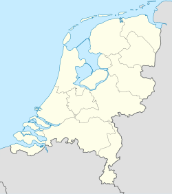
Scheerwolde is a village in the municipality of Steenwijkerland in the province of Overijssel in the Netherlands. As of 2023, Scheerwolde had a population of 620.[1] The village is not far northeast from Blokzijl, near the provincial road N333 between Marknesse and Steenwijk. The village is located on the Steenwijkerdiep, between the nature reserves De Weerribben and De Wieden.
History
[edit]Scheerwolde is a relatively new village, as it only came into being in 1952. It is located in a reclaimed part of the Weerribben-Wieden. After peat excavations, part of the area was reclaimed again. The land became water and water became land again, after which a new village emerged.[3]
Notable people
[edit]- Saskia de Jonge, swimmer (born 1986)
References
[edit]- ^ a b c d "Kerncijfers wijken en buurten 2023". Statistics Netherlands. Retrieved 27 October 2024.
- ^ "AHN Viewer". Actueel Hoogtebestand Nederland (in Dutch). Het Waterschapshuis. Retrieved 27 October 2024.
- ^ "Scheerwolde". Nationaal Park Weerribben-Wieden (in Dutch). Retrieved 27 October 2024.


