Sanzu River (Burundi)
| Sanzu River | |
|---|---|
| Native name | Rivière Sanzu (French) |
| Location | |
| Country | Burundi |
| Physical characteristics | |
| Mouth | |
• location | Nyabaha River |
• coordinates | 3°25′26″S 30°04′46″E / 3.42398°S 30.07939°E |
The Sanzu River (French: Rivière Sanzu) is a river in Burundi, a right tributary of the Nyabaha River.
Course
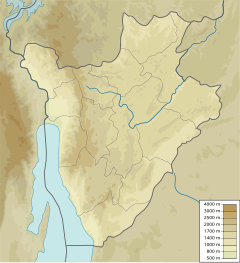
[edit]The Sanzu River forms in the east of Ruyigi Province to the southwest of Kigamba and northwest of the city of Ruyigi. It is formed where the Rusabagi River from the northwest joins the Rutimbura River from the southeast. It flows west to join the Nyakijanda River, which flows from the south.[1] The combined stream is the Nyabaha River, which flows northwest to join the Ruvubu River.[2] The Sanzu flows through the Commune of Ruyigi and the Commune of Butaganzwa.[3]
Environment
[edit]The surroundings of the Sanzu river are a mosaic of farmland and natural vegetation.[4] The area is quite densely populated, with 111 inhabitants per square kilometer as of 2016.[5] The average annual temperature in the area is 19 °C (66 °F). The warmest month is September, when the average temperature is 22 °C (72 °F), and the coldest is April, with 18 °C (64 °F).[6] Average annual rainfall is 1,321 millimetres (52.0 in). The rainiest month is December, with an average of 215 millimetres (8.5 in) of precipitation, and the driest is July, with 1 millimetre (0.039 in) of precipitation.[7]
Issues
[edit]There is an old hydroelectric dam owned by Regideso on the Sanzu River on the Ruyigi-Kayongozi road, about 3 kilometres (1.9 mi) from Ruyigi. The power plant ceased to function in 2000, and the canal that carried water to the plant became clogged due to lack of maintenance. This has caused flooding to several rice fields along a 13 kilometres (8.1 mi) stretch. In April 2023 one of the pipes broke, causing further damage.[8]
In May 2023 torrential rain caused the flooding of marshes beside the Sanzu River in Ruhwago colline, Commune of Ruyigi. Beans, corn, potatoes, sweet potatoes and other crops were washed away about three weeks before they were to be harvested.[9]
See also
[edit]References
[edit]Sources
[edit]- Investment opportunities in renewable energy Burundi (PDF), Minister for Energy and Mines, October 2012, p. 14, retrieved 2024-08-31
- NASA Earth Observations: Population Density, NASA/SEDAC, archived from the original on 9 February 2016, retrieved 30 January 2016
- NASA Earth Observations Data Set Index, NASA, archived from the original on 28 November 2017, retrieved 30 January 2016 Temperature data from satellite measurements of the earth's surface temperature within a box that is 0.1×0.1 degres.
- NASA Earth Observations: Rainfall (1 month - TRMM), NASA/Tropical Rainfall Monitoring Mission, archived from the original on 19 April 2019, retrieved 30 January 2016 Average value for the years 2012–2014 within a box that is 0.1×0.1 degres.
- NASA Earth Observations: Land Cover Classification, NASA/MODIS, archived from the original on 28 February 2016, retrieved 30 January 2016
- "Plusieurs champs de riz détruits par un barrage de la Regideso, hors service", Agence Burundaise de Presse (in French), 12 April 2023, retrieved 2024-09-01
- Projet de rehabilitation de la route Makebuko – Ruyigi (RN13) – Phase 1 / Troncon Makebuko – Butanganzwa (PDF) (in French), African Development Bank Group, retrieved 2024-09-01
- Ruyigi (PDF), United States Government Defense Mapping Agency, 1994, retrieved 2024-09-01
- "Ruyigi : les pluies torrentielles font des dégâts", Iwacu (in French), 5 May 2013, retrieved 2024-09-01

