Sant Guim de Freixenet
Appearance
Sant Guim de Freixenet | |
|---|---|
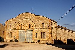
 Sant Guim agricultural co-op | |
| Coordinates: 41°39′27″N 1°25′19″E / 41.65750°N 1.42194°E | |
| Country | |
| Community | |
| Province | Lleida |
| Comarca | Segarra |
| Government | |
| • mayor | Francesc Lluch Majoral (2015)[1] |
| Area | |
• Total | 25.1 km2 (9.7 sq mi) |
| Elevation | 738 m (2,421 ft) |
| Population (2018)[3] | |
• Total | 1,040 |
| • Density | 41/km2 (110/sq mi) |
| Website | www |
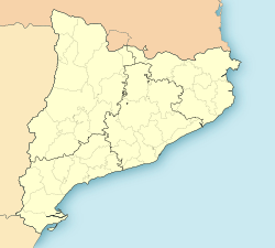
Sant Guim de Freixenet (Catalan pronunciation: [ˈsaŋ ˈgim de fɾejʃeˈnet]) is a municipality in the comarca of la Segarra in Catalonia, Spain.

History
[edit]Owing to the intense military activity at the Lleida front, this municipality suffered much during the Spanish Civil War (1936–1939).
At that time it was known as Pineda de Segarra and, owing to the hardships caused by the war, paper money was printed in the town.[4] The present-day main town was formerly known as Sant Guim de l'Estació because it was built around the railway station of the Lleida - Manresa line.
Nowadays many of the villages that make up the municipality have been depopulated as people have moved to urban areas. Most have only residual population.
Villages
[edit]- Altadill, 0
- Amorós, 10
- El Castell de Santa Maria, 12
- Freixenet de Segarra, 44
- Melió, 6
- Palamós 0
- La Rabassa, 26
- Sant Domí, 21
- Sant Guim de Freixenet, 868
- Sant Guim de la Rabassa, 22
- La Tallada, 48
References
[edit]- ^ "Ajuntament de Sant Guim de Freixenet". Generalitat of Catalonia. Retrieved 2015-11-13.
- ^ "El municipi en xifres: Sant Guim de Freixenet". Statistical Institute of Catalonia. Retrieved 2015-11-23.
- ^ Municipal Register of Spain 2018. National Statistics Institute.
- ^ Isidre Aymerich, El paper moneda, els bons i els vals a la Segarra durant la Guerra Civil (1936–1939)
External links
[edit]Wikimedia Commons has media related to Sant Guim de Freixenet.


