San Antonio, Canelones
Appearance
San Antonio | |
|---|---|
Village | |
 Marcelino-Moreira street, San Antonio, Canelones | |
| Coordinates: 34°27′0″S 56°5′0″W / 34.45000°S 56.08333°W | |
| Country | |
| Department | Canelones Department |
| Population (2011) | |
• Total | 1,489 |
| Time zone | UTC -3 |
| Postal code | 90002 |
| Dial plan | +598 4313 (+4 digits) |
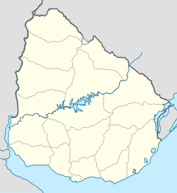
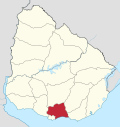
San Antonio is a village in the Canelones Department of southern Uruguay.
San Antonio is also the name of the municipality to which the town belongs.
Location
[edit]The village is located on Km.55 of Route 33, 3.3 kilometres (2.1 mi) south of its intersection with Route 81.
History
[edit]Its status was elevated to "Pueblo" (village) by Decree of 14 November 1875.[1]
Population
[edit]In 2011 San Antonio had a population of 1,489.[2] The Intendencia de Canelones has estimated a population of 3,552 for the municipality.[3]

| Year | Population |
|---|---|
| 1908 | 2,919 |
| 1963 | 899 |
| 1975 | 1,120 |
| 1985 | 1,106 |
| 1996 | 1,293 |
| 2004 | 1,434 |
| 2011 | 1,489 |
Source: Instituto Nacional de Estadística de Uruguay[1]

Notable people
[edit]- José Arbío, football player.
- Yamandú Orsi, politician.
Places of worship
[edit]References
[edit]- ^ a b "Statistics of urban localities (1908–2004)" (PDF). INE. 2012. Retrieved 9 September 2012.
- ^ "Censos 2011 Cuadros Canelones". INE. 2012. Retrieved 25 August 2012.
- ^ "Municipio de San Antonio". Comuna Canaria / Dpto. de Canelones. Retrieved 27 August 2012.
External links
[edit]Wikimedia Commons has media related to San Antonio, Canelones.


