Ruprechtov
Ruprechtov | |
|---|---|
 Windmill | |
| Coordinates: 49°19′43″N 16°51′5″E / 49.32861°N 16.85139°E | |
| Country | |
| Region | South Moravian |
| District | Vyškov |
| First mentioned | 1446 |
| Area | |
• Total | 11.48 km2 (4.43 sq mi) |
| Elevation | 514 m (1,686 ft) |
| Population (2024-01-01)[1] | |
• Total | 631 |
| • Density | 55/km2 (140/sq mi) |
| Time zone | UTC+1 (CET) |
| • Summer (DST) | UTC+2 (CEST) |
| Postal code | 683 06 |
| Website | www |
Ruprechtov is a municipality and village in Vyškov District in the South Moravian Region of the Czech Republic. It has about 600 inhabitants.
Geography
[edit]Ruprechtov is located about 11 kilometres (7 mi) northwest of Vyškov and 20 km (12 mi) northeast of Brno. It lies in the Drahany Highlands. The highest point is at 554 m (1,818 ft) above sea level.
History
[edit]The first written mention of Ruprechtov is from 1446, when it was part of the Račice estate, owned by the Lords of Kravaře.[2]
Demographics
[edit]
|
|
| ||||||||||||||||||||||||||||||||||||||||||||||||||||||
| Source: Censuses[3][4] | ||||||||||||||||||||||||||||||||||||||||||||||||||||||||
Transport
[edit]There are no railways or major roads passing through the municipality.
Sights
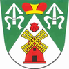
[edit]The municipality is known for the Ruprechtov Windmill. This classical Dutch-type windmill was built in 1873 and is equipped with a Halladay turbine, which makes it a unique technical monument of European importance.[5]
The Church of Saint Wenceslaus is a modern building dating from 1946.[6]
References
[edit]- ^ "Population of Municipalities – 1 January 2024". Czech Statistical Office. 2024-05-17.
- ^ "Z historie obce" (in Czech). Obec Ruprechtov. Retrieved 2024-02-21.
- ^ "Historický lexikon obcí České republiky 1869–2011" (in Czech). Czech Statistical Office. 2015-12-21.
- ^ "Population Census 2021: Population by sex". Public Database. Czech Statistical Office. 2021-03-27.
- ^ "Windmill history". Ruprechtov Windmill. Retrieved 2023-07-26.
- ^ "Ekumenická bohoslužba v Ruprechtově na Vyškovsku" (in Czech). Czechoslovak Hussite Church. 2023-02-07. Retrieved 2023-07-26.


