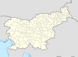
Rudnik pri Radomljah
Appearance
Rudnik pri Radomljah | |
|---|---|
 | |
| Coordinates: 46°11′52.05″N 14°37′38.49″E / 46.1977917°N 14.6273583°E | |
| Country | |
| Traditional region | Upper Carniola |
| Statistical region | Central Slovenia |
| Municipality | Kamnik |
| Area | |
• Total | 2.69 km2 (1.04 sq mi) |
| Elevation | 377.8 m (1,239.5 ft) |
| Population (2002) | |
• Total | 50 |
| [1] | |
Rudnik pri Radomljah (pronounced [ˈɾuːdnik pɾi ˈɾaːdɔmljax]) is a dispersed settlement of isolated small farms on the hills above Volčji Potok in the Municipality of Kamnik in the Upper Carniola region of Slovenia.
Name
[edit]Rudnik pri Radomljah was attested in written sources as Ruͤdnik in 1359.[2] The name of the settlement was changed from Rudnik to Rudnik pri Radomljah (literally, 'Rudnik near Radomlje') in 1955.[3][4]
References
[edit]- ^ Statistical Office of the Republic of Slovenia
- ^ Kosi, Miha (2016). Historična topografija Kranjske (do 1500). Ljubljana: Založba ZRC. p. 1240.
- ^ "Zakon o območjih okrajev in občin v Ljudski republiki Sloveniji". Uradni list Ljudske republike Slovenije. 12 (24): 493. June 30, 1955. Retrieved February 6, 2022.
- ^ Spremembe naselij 1948–95. 1996. Database. Ljubljana: Geografski inštitut ZRC SAZU, DZS.
External links
[edit] Media related to Rudnik pri Radomljah at Wikimedia Commons
- Rudnik pri Radomljah on Geopedia


