Rakvice
Rakvice | |
|---|---|
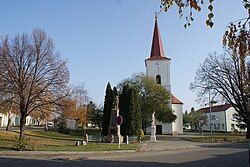
 Centre of Rakvice | |
| Coordinates: 48°51′29″N 16°48′48″E / 48.85806°N 16.81333°E | |
| Country | |
| Region | South Moravian |
| District | Břeclav |
| First mentioned | 1248 |
| Area | |
• Total | 21.79 km2 (8.41 sq mi) |
| Elevation | 164 m (538 ft) |
| Population (2024-01-01)[1] | |
• Total | 2,308 |
| • Density | 110/km2 (270/sq mi) |
| Time zone | UTC+1 (CET) |
| • Summer (DST) | UTC+2 (CEST) |
| Postal code | 691 03 |
| Website | www |
Rakvice is a municipality and village in Břeclav District in the South Moravian Region of the Czech Republic. It has about 2,300 inhabitants.
Etymology
[edit]The name is derived from the personal name Rak. The word rak means 'crayfish' in Czech.[2]
Geography
[edit]Rakvice is located about 12 kilometres (7 mi) north of Břeclav and 40 km (25 mi) south of Brno. It lies in a flat agricultural landscape in the Lower Morava Valley. The Trkmanka River flows through the municipality. The territory of Rakvice is rich in fishponds.
History
[edit]The first written mention of Rakvice is from 1248. In 1604 at the latest, it became a market town, however the Thirty Years' War devastated Rakvice and it became a village again.[3]
Demographics
[edit]
|
|
| ||||||||||||||||||||||||||||||||||||||||||||||||||||||
| Source: Censuses[4][5] | ||||||||||||||||||||||||||||||||||||||||||||||||||||||||
Economy
[edit]
Rakvice is known for its large vineyards and is known for its long wine-making tradition.[3] It lies in the Velkopavlovická wine subregion.
Transport
[edit]The D2 motorway (part of the European route E65) from Brno to Břeclav passes through the municipal territory.
Rakvice is located on the Brno–Staré Město railway line.[6]
Sights
[edit]The main landmark of Rakvice is the Church of Saint John the Baptist. After the original church was completely destroyed during the Thirty Years' War, it was rebuilt and extended in the second half of the 17th century.[7]
References
[edit]- ^ "Population of Municipalities – 1 January 2024". Czech Statistical Office. 2024-05-17.
- ^ "Rakvický zpravodaj červen 2013" (in Czech). Obec Rakvice. 2013-06-06. p. 2. Retrieved 2023-12-29.
- ^ a b "Historie" (in Czech). Obec Rakvice. Retrieved 2023-12-29.
- ^ "Historický lexikon obcí České republiky 1869–2011" (in Czech). Czech Statistical Office. 2015-12-21.
- ^ "Population Census 2021: Population by sex". Public Database. Czech Statistical Office. 2021-03-27.
- ^ "Detail stanice Rakvice" (in Czech). České dráhy. Retrieved 2023-12-29.
- ^ "Kostel svatého Jana Křtitele". Úžasná Morava (in Czech). Retrieved 2023-12-29.


