Punta Križa
Appearance
Punta Križa
Punta Croce | |
|---|---|
Village | |
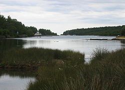
 Punta Križa bay | |
| Coordinates: 44°38′16″N 14°29′40″E / 44.63784°N 14.49444°E | |
| Country | |
| County | |
| Town | Mali Lošinj |
| Area | |
• Total | 40.3 km2 (15.6 sq mi) |
| Population (2021)[2] | |
• Total | 46 |
| • Density | 1.1/km2 (3.0/sq mi) |
| Time zone | UTC+1 (CET) |
| • Summer (DST) | UTC+2 (CEST) |
| Postal code | 51554 |
| Area code | 051 |
| Vehicle registration | RI |
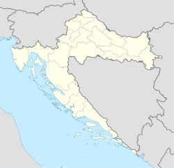
Punta Križa (Italian: Punta Croce) is a village on the southern end of the Croatian island of Cres, in Primorje-Gorski Kotar. Administratively, it is part of the town of Mali Lošinj. As of 2021, it had a population of 46.[2] There are at least two marinas in the region.[3]
Etymology
[edit]Punta Križa as a term has implications for ancient maritime traditions since wooden crosses which are called križ in Croatian were indicators of the safe harbours before lighthouses and other signal tools were employed to support navigation.[4]
References
[edit]- ^ Register of spatial units of the State Geodetic Administration of the Republic of Croatia. Wikidata Q119585703.
- ^ a b "Population by Age and Sex, by Settlements" (xlsx). Census of Population, Households and Dwellings in 2021. Zagreb: Croatian Bureau of Statistics. 2022.
- ^ "Marinas in Punta Kriza, Croatia". marinas.com. Retrieved 31 March 2023.
- ^ Michael Doneus; et al. (2011). "Confronting Complexity: Interpretation of a Dry Stone Walled Landscape on the Island of Cres, Croatia". Land. 11 (10): 1672. doi:10.3390/land11101672.
External links
[edit]![]() Media related to Punta Križa at Wikimedia Commons
Media related to Punta Križa at Wikimedia Commons
https://en.m.wikipedia.org/wiki/Punta_Kri%C5%BEa#cite_note-marina-3

