Portal:Earth sciences/Selected pictures
Appearance
-
A 2002 eruption of Mount Etna, a volcano on the Italian island of Sicily, viewed from the International Space Station. (Credit: NASA, with image edits by User:Darkone.)
-
Northern shore meadows of Sihlsee, an artificial lake near Einsiedeln in the Canton of Schwyz, Switzerland. (Credit: Markus Bernet.)
-
Pressure release of granite in the Enchanted Rock State Natural Area of Texas, United States. The photo shows the geological exfoliation of granite dome rock. (Taken by Wing-Chi Poon on 2nd April 2005.)
-
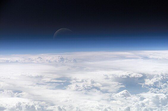
Atmospheric gases scatter blue wavelengths of visible light more than other wavelengths, giving the Earth’s visible edge a blue halo. At higher and higher altitudes, the atmosphere becomes so thin that it essentially ceases to exist. Gradually, the atmospheric halo fades into the blackness of space. (Credit: NASA's Earth Observatory.)
-
Astronauts aboard the Space Shuttle Discovery recorded this rarely seen phenomenon of the full Moon partially obscured by the atmosphere of Earth. The image was recorded with an electronic still camera at 15:15:15 GMT, Dec. 21, 1999. (Credit: NASA.)
-
A true-color picture of Ireland, as seen from space, with the Atlantic Ocean to the west and the Irish Sea to the east.
-
The Richat Structure is a depression in the country of Mauritania, almost 50 km (30 mi) across. It was originally thought to be the impact of a meteorite. Now it is thought to be a symmetrical uplift (circular anticline or dome) that has been exposed to erosion. In this false-color photo, bedrock is brown, sand is yellow and white, vegetation is green, and salty sediments are blue. (Credit: Landsat 7.)
-
The world's largest compass rose, drawn on the desert floor at Edwards Air Force Base in California, United States. Painted on the playa near Dryden Flight Research Center, it is inclined to magnetic north and is used by pilots for calibrating heading indicators. (Credit: NASA.)
-
Oceans cover almost three quarters (71%) of the surface of the Earth, and nearly half of the world's marine waters are over 3000 m deep. This global, interconnected body of salt water, called the World Ocean, is divided by the continents and archipelagos into the following five bodies, from the largest to the smallest: the Pacific Ocean, the Atlantic Ocean, the Indian Ocean, the Southern Ocean, and the Arctic Ocean. Official boundaries are defined by the International Hydrographic Organization. (Credit: Alexandre Van de Sande.)
-
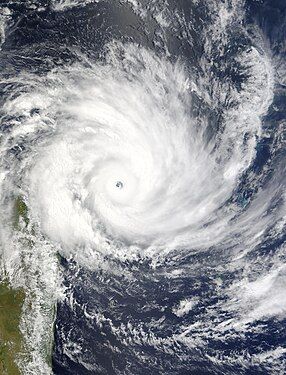
Satellite image of Cyclone Gafilo, a powerful Category 5 tropical cyclone which struck Madagascar in March 2004, causing devastating damage. This was taken just before landfall, when the system was at its peak intensity about 333 km (207 mi) east of Madagascar, with sustained windspeed of 260 km/h (160 mph). At least 250 people were listed dead, with more missing, and 300,000 people were left homeless due to Gafilo. (Credit: Terra satellite, NASA.)
-
Erg Chebbi (Arabic: عرج شبّي) is the sole Saharan erg in Morocco. It is 22 km long (North-South) and 5 km wide. Its dunes reach a maximum height of 150 meters. It is located roughly 40 kilometers south-east of Erfoud. The local center for tourists is the village of Merzouga. (Credit: Rosa Cabecinhas and Alcino Cunha.)
-
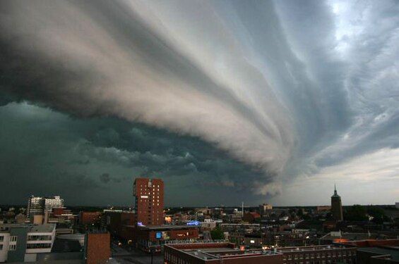
A thunderstorm is a form of severe weather involving lightning and thunder. Thunderstorms have had a lasting and powerful influence on mankind. Romans thought them to be battles waged by Jupiter. Thunderstorms were associated with the Thunderbird, held by Native Americans to be a servant of the Great Spirit. (Credit: John Kerstholt.)
-
This map shows the tracks of all tropical cyclones that formed worldwide from 1985 to 2005. The points show the locations of the storms at six-hourly intervals and use the color scheme shown on the right from the Saffir-Simpson Hurricane Scale. (Credit: Nilfanion.)
-
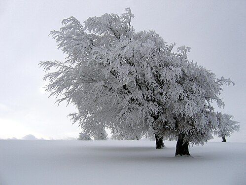
Winter is one of the four seasons of temperate zones. Meteorological winter is the season having the shortest days (which vary greatly according to latitude) and the lowest temperatures. (Credit: Richard Fabi.)
-
Cirrus clouds are composed of ice crystals and shaped like hairlike filaments. They are formed at an altitudes above 5000 metres (16,500 feet). The streaks are made of snowflakes that are falling from the cloud and being caught by the high level winds. The streaks point in the direction of the wind and may appear straight giving the clouds the appearance of a comma (cirrus uncinus), or may by seem tangled, an indication of high level turbulence. (Credit: Piccolo Namek.)
-
Hurricane Katrina was the third most powerful storm of the 2005 Atlantic hurricane season. It first made landfall as a Category 1 hurricane just north of Miami, Florida on August 25, 2005, then again on August 29 along the Central Gulf Coast near Buras-Triumph, Louisiana as a Category 4 storm. This photograph of the eye of the hurricane was taken from a NOAA Hurricane Hunter aircraft on August 28, 2005. (Credit: NOAA.)
-
An October 2002 eruption of Mount Etna, a volcano on the Italian island of Sicily, as seen from the International Space Station. Etna is the largest of Italy's three active volcanoes and one of the most active in the whole entire world. This eruption, one of Etna's most vigorous in years, was triggered by a series of earthquakes. Ashfall was reported as far away as Libya, 600 km (373 mi) to the south. (Credit: Expedition 5 crew.)
-
Antarctica, the continent surrounding the Earth's South Pole, is the coldest place on earth and is almost entirely covered by ice. Antarctica was discovered in late January 1820. Too cold and dry to support virtually any vascular plants, Antarctica's flora presently consists of around 250 lichens, 100 mosses, 25-30 liverworts, and around 700 terrestrial and aquatic algal species. (Credit: NASA.)
-
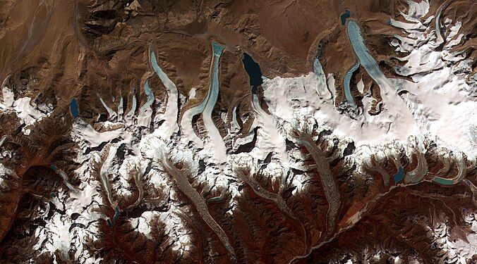
Glacier retreat is a type of glacial motion in which more material ablates from its terminus of the glacier than is replenished by flow into that region. In this region of the Bhutan-Himalaya, glacial lakes have been rapidly forming on the surface of the debris-covered glaciers and researchers have found a strong correlation between increasing temperatures and glacial retreat. (Credit: NASA & USGS.)


