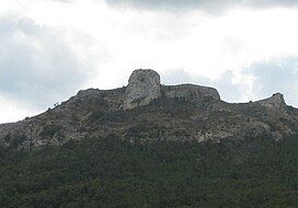
Picorandan
Appearance
| Picorandan | |
|---|---|
 | |
| Highest point | |
| Elevation | 991 m (3,251 ft) |
| Listing | Mountains in Catalonia |
| Coordinates | 41°17′16.5″N 01°01′01.8″E / 41.287917°N 1.017167°E |
| Geography | |
| Location | Baix Camp, Catalonia |
| Parent range | Serra Plana |
| Climbing | |
| Easiest route | From Capafonts |
Picorandan is a mountain of Catalonia, Spain. It is part of the Catalan Pre-Coastal Range. Its maximum elevation is 991 metres above sea level.[1]
See also
[edit]References
[edit]- ^ "Mapa Topogràfic de Catalunya". Institut Cartogràfic de Catalunya. Retrieved May 22, 2010..


