Petzeck
Appearance
This article needs additional citations for verification. (January 2015) |
| Petzeck | |
|---|---|
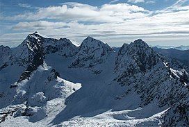
 Petzeck (far left) | |
| Highest point | |
| Elevation | 3,283 m (10,771 ft) |
| Prominence | 799 m (2,621 ft)[1] |
| Listing | Alpine mountains above 3000 m |
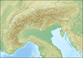
| Coordinates | 46°56′53″N 12°48′14″E / 46.94806°N 12.80389°E |
| Geography | |
| Location | Carinthia, Austria |
| Parent range | High Tauern |
| Climbing | |
| First ascent | 1844[2] |
Petzeck (3,283m) is the highest mountain of the Schober Group in the High Tauern range, Austria. The mountain has a 1,000m high north face but its southern slope is more gentle, with lakes such as Kreuzsee and Wangenitzsee on its slopes. Its south western slope is glaciated.[3]
The mountain is quieter than its near neighbours such as Grossglockner or Hoher Sonnblick.[3]
References
[edit]

