Pereš
Appearance
Pereš | |
|---|---|
Borough | |
 Church of the Holy Trinity in Pereš | |
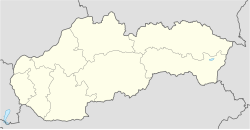
 Location within Košice | |
| Coordinates: 48°41′20″N 21°12′42″E / 48.68889°N 21.21167°E | |
| Country | Slovakia |
| Region | Košice |
| District | Košice II |
| Locality | 1937 (first known record) |
| Area | |
• Total | 1.33 km2 (0.51 sq mi) |
| Elevation | 297 m (974 ft) |
| Population (31 December 2017) | |
• Total | 1,939 |
| • Density | 1,500/km2 (3,800/sq mi) |
| Postal code | 040 11 |
| Area code | +421-55 |
| Car plate | KE |
| Website | www.mcperes.sk |
| Source [1] | |
Pereš (Hungarian: Peres) is a borough (city ward) of the city of Košice, Slovakia. Located in the Košice II district, it lies at an altitude of roughly 297 metres (974 ft) above sea level, and is home to nearly 2,000 people. It's one of the smaller boroughs of its district and consists mainly of housing.
History
[edit]One of the younger boroughs of the city, the first written record of Pereš dates back to 1937.
Statistics
[edit]- Area: 1.33 square kilometres (0.51 sq mi)
- Population: 1,939 (31 December 2017)
- Density of population: 1,500/km2 (31 December 2017)
- District: Košice II
- Mayor: Jozef Karabin (as of 2018 elections)
Gallery
[edit]-
Bystrická Street
-
Newer housing development in the Pereš borough
-
Newer housing development in the Pereš borough
-
Newer housing development in the Pereš borough
-
Newer housing development in the Pereš borough
References
[edit]- ^ Mestská a obecná štatistika SR (urgently needs an updated statistics link for 2018) Archived 2007-04-27 at the Wayback Machine
External links
[edit]Wikimedia Commons has media related to Pereš.
- Official website of the Pereš borough
- Article on the Pereš borough at Cassovia.sk
- Official website of the town of Košice


