Paruro province
Paruro | |
|---|---|
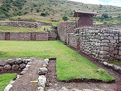
 Archaeological site of Maucallacta in the Paccaritambo District | |
 Location of Paruro in the Cusco Region | |
| Country | Peru |
| Region | Cusco |
| Capital | Paruro |
| Government | |
| • Mayor | Adolfo Santiago Fernandez Baca Loaiza (2007) |
| Area | |
• Total | 1,984.42 km2 (766.19 sq mi) |
| Population (2005 census) | |
• Total | 32,244 |
| • Density | 16/km2 (42/sq mi) |
| UBIGEO | 0810 |
Paruro Province is one of thirteen provinces in the Cusco Region in the southern highlands of Peru.
The provincial capital of Paruro, with a population of 3,855, lies at 3,057 meters (10,032 ft) altitude.[1] Two and a half hours by bus from Cusco, at the bottom of a deep valley, it is bordered on one side by the Rio Paruro, a feeder of the Apurímac River. A number of small Inca and pre-Inca ruins are in the area, and a series of arches was built by Simón Bolívar to celebrate a victory over the Spaniards.
Nearby Paqariq Tampu is one of the legendary origin sites of Manqu Qhapaq and Mama Uqllu, founders of the Inca Empire.
Boundaries
[edit]- North: Anta Province and Cusco Province
- East: Quispicanchi Province, Acomayo Province and Chumbivilcas Province
- South: Chumbivilcas Province
- West: Chumbivilcas Province and Apurímac Region
Geography
[edit]Some of the highest mountains of the province are listed below:[2]
- Achiwan
- Anqas
- Awkis
- Chaku Urqu
- Chawpi
- Ch'iyar Jaqhi
- Chuqichampi
- Inti Watana
- Kancha Q'asa
- Kimsa Chata
- Kimsa Pukyu
- Kiru
- Kunturi
- Kuntur Sinqa
- Khipu
- Llama Kunka
- Lluthuq Q'asa
- Mallqu Q'asa
- Mawk'a Llaqta
- Ñaqha Pukara
- Pilluni
- Puka Q'asa
- Puma Ranra
- Puma Suyru
- Puma Urqu
- Pumawasi
- Puyka
- P'unqu Q'asa
- Qiwiña
- Qullpa
- Qullu Puphasqa
- Qupani
- Quri Pata
- Q'illu
- Runtu Urqu
- Ruq'a
- Saywa
- Sullk'an Urqu
- Suyt'u
- Taway Q'asa
- Tawqa
- Tawqa Urqu
- Umaqucha
- Ura Qaqa
- Waka Pakana
- Wallata
- Waman Pata
- Wanakawri
- Wanaku
- Wark'a Simp'ana
- Warkhuyuq
- Wathiyayuq
- Wayllayuq
- Wayruru
- Waytaqucha
- Willkani
Political division
[edit]The province is divided into nine districts (Spanish: distritos, singular: distrito), each of which is headed by a mayor (alcalde). The districts, with their capitals in parentheses, are:
- Accha (Accha)
- Ccapi (Ccapi)
- Colcha (Colcha)
- Huanoquite (Huanoquite)
- Omacha (Omacha)
- Paccaritambo (Paccaritambo)
- Paruro (Paruro)
- Pillpinto (Pillpinto)
- Yaurisque (Yaurisque)
Ethnic groups
[edit]The people in the province are mainly indigenous citizens of Quechua descent. Quechua is the language which the majority of the population (92.09%) learnt to speak in childhood, 7.56% of the residents started speaking in Spanish (2007 Peru Census).[3]
See also
[edit]References
[edit]- ^ Paruro
- ^ escale.minedu.gob.pe - UGEL map of the Paruro Province (Cusco Region)
- ^ inei.gob.pe Archived 2013-01-27 at the Wayback Machine INEI, Peru, Censos Nacionales 2007
13°45′48″S 71°50′58″W / 13.76333°S 71.84944°W

