Pallisa
Pallisa | |
|---|---|
| Coordinates: 01°10′03″N 33°42′36″E / 1.16750°N 33.71000°E | |
| Country | |
| Region | Eastern Region of Uganda |
| District | Pallisa District |
| Elevation | 3,510 ft (1,070 m) |
| Population (2020 Estimate) | |
• Total | 42,300[1] |
Pallisa is a town in Pallisa District of the Eastern Region of Uganda.[2]

Geography
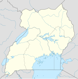
[edit]Pallisa is approximately 56 kilometres (35 mi), by road, west of Mbale, the largest city in the Eastern Region of Uganda.[3] This is approximately 200 kilometres (120 mi), by road, northeast of Kampala, the capital of Uganda.[4] The coordinates of the town are 1°10'03.0"N, 33°42'36.0"E (Latitude:1.1675; Longitude:33.7100).[5]
Overview
[edit]The town of Pallisa is in a rural area with limited public transportation. One of the major activities include schooling, with the population of the town swelling to around 40,000 when school is in session. Children come from all around to go to one of the approximately twenty secondary schools in the area, where they live in huts, two to four students per hut, rented to them by villagers. The students fend entirely for themselves while going to school.[6]
Population
[edit]In 2014, the national population census and household survey, put the population at 32,681. In 2020, UBOS estimated the mid-year population of the town at 42,300. The population agency calculated the average annual growth rate of Pallisa's population at 4.26 percent per year, between 2014 and 2020.[1]
Points of interest
[edit]The following additional points of interest lie within the town limits or near its borders:[5]
1. The headquarters of Pallisa District Administration
2. The offices of Pallisa Town Council
3. Pallisa Central Market
4. A mobile branch of PostBank Uganda
5. The Pallisa Campus of Busitema University, one of the public universities in Uganda
6. The Tirinyi–Pallisa–Kamonkoli–Kumi Road passes through the middle of town.[7]
7. Pallisa General Hospital, a 100-bed capacity public hospital, that serves Pallisa District and neighboring communities.[8]
See also
[edit]- List of cities and towns in Uganda
- Juliet Rainer Kafiire, Ugandan politician and legislator who represented Kibuku County in Pallisa between 1994 and 2006
References
[edit]- ^ a b UBOS (14 June 2020). "Estimated Population of Pallisa Town In 2014 and 2020". Citypopulation.de Quoting Uganda Bureau of Statistics (UBOS). Retrieved 3 January 2021.
- ^ Moses Nampala (25 September 2018). "Power Distributor Umeme Lights Up Pallisa Town". New Vision. Kampala. Retrieved 3 January 2021.
- ^ "Road Distance Between Mbale, Uganda And Pallisa, Uganda" (Map). Google Maps. Retrieved 3 January 2021.
- ^ "Road Distance Between Kampala, Uganda nd Pallisa, Uganda" (Map). Google Maps. Retrieved 3 January 2021.
- ^ a b "Location of Pallisa Town, Eastern Region, Uganda" (Map). Google Maps. Retrieved 3 January 2020.
- ^ Nawonga, Susan (23 April 2014). "Government Reboots Education Standards in Eastern Uganda". Chimpreports.com. Retrieved 28 May 2014.
- ^ Francis Emorut (7 January 2014). "Govt earmarks sh304.2b for Tirinyi-Pallisa-Kumi road". New Vision. Kampala. Retrieved 3 January 2021.
- ^ Ayubu Kirinya (21 December 2019). "Pallisa Hospital Seeks Over Ugx200M to Rehabilitate Children's Ward". Kampala: Uganda Radio Network. Retrieved 3 January 2021.


