Ottenhofen (Oberbayern) station
Appearance
| General information | |||||||||||
|---|---|---|---|---|---|---|---|---|---|---|---|
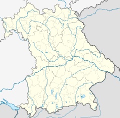
| Location | Raiffeisenstraße 13 85570 Ottenhofen Bavaria Germany | ||||||||||
| Coordinates | 48°13′06″N 11°52′46″E / 48.2182°N 11.8794°E | ||||||||||
| Owned by | Deutsche Bahn | ||||||||||
| Operated by | |||||||||||
| Line(s) | |||||||||||
| Platforms | 1 island platform | ||||||||||
| Tracks | 2 | ||||||||||
| Train operators | S-Bahn München | ||||||||||
| Connections | |||||||||||
| Other information | |||||||||||
| Station code | 4825 | ||||||||||
| DS100 code | MONH[1] | ||||||||||
| IBNR | 8004723 | ||||||||||
| Category | 5[2] | ||||||||||
| Fare zone | |||||||||||
| Website | www.bahnhof.de | ||||||||||
| History | |||||||||||
| Opened | 16 November 1872[4] | ||||||||||
| Services | |||||||||||
| |||||||||||
 | |||||||||||
Ottenhofen (Oberbayern) station is a railway station in the municipality of Ottenhofen, located in the Erding district in Upper Bavaria, Germany.
References
[edit]- ^ Eisenbahnatlas Deutschland (German railway atlas) (2009/2010 ed.). Schweers + Wall. 2009. ISBN 978-3-89494-139-0.
- ^ "Stationspreisliste 2025" [Station price list 2025] (PDF) (in German). DB Station&Service. 28 November 2024. Retrieved 5 December 2024.
- ^ "S-Bahn, U-Bahn, Regionalzug, Tram und ExpressBus im MVV" (PDF). Münchner Verkehrs- und Tarifverbund. December 2019. Retrieved 28 February 2020.
- ^ Korhammer, Klaus-Dieter; Franzke, Armin; Rudolph, Ernst (1991), Lisson, Peter (ed.), Drehscheibe des Südens. Eisenbahnknoten München (in German), Darmstadt: Hestra-Verlag, p. 155, ISBN 3-7771-0236-9.


