Oborná
Oborná | |
|---|---|
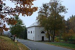
 Church of the Holy Trinity | |
| Coordinates: 50°0′11″N 17°29′49″E / 50.00306°N 17.49694°E | |
| Country | |
| Region | Moravian-Silesian |
| District | Bruntál |
| First mentioned | 1405 |
| Area | |
• Total | 5.33 km2 (2.06 sq mi) |
| Elevation | 495 m (1,624 ft) |
| Population (2024-01-01)[1] | |
• Total | 452 |
| • Density | 85/km2 (220/sq mi) |
| Time zone | UTC+1 (CET) |
| • Summer (DST) | UTC+2 (CEST) |
| Postal code | 792 01 |
| Website | www |
Oborná (until 1947 Špilendorf; German: Spillendorf) is a municipality and village in Bruntál District in the Moravian-Silesian Region of the Czech Republic. It has about 500 inhabitants.
Geography
[edit]Oborná is located about 2 kilometres (1 mi) northeast of Bruntál and 57 km (35 mi) northwest of Ostrava. It lies in the Nízký Jeseník range. The highest point is at 632 m (2,073 ft) above sea level. The built-up area lies in the valley of the brook of Oborenský potok.
History
[edit]The first written mention of Špilendorf is from 1405.[2]
According to the Austrian census of 1910, the municipality had 511 inhabitants, all of them were German-speaking. The most-populous religious group were Roman Catholics with 505 (98.8%).[3]
In 1947, the municipality was renamed from Špilendorf to its current name.[4]
Demographics
[edit]
|
|
| ||||||||||||||||||||||||||||||||||||||||||||||||||||||
| Source: Censuses[5][6] | ||||||||||||||||||||||||||||||||||||||||||||||||||||||||
Transport
[edit]
The I/45 road from Bruntál to Krnov passes through the municipality.
The railway line Bruntál–Milotice nad Opavou runs through the municipal territory, but there is no train station. The municipality is servedy by the station in neighbouring Bruntál.
Sights
[edit]There are no protected cultural monuments in the municipality.[7] The main landmark is the Church of the Holy Trinity.
References
[edit]- ^ "Population of Municipalities – 1 January 2024". Czech Statistical Office. 2024-05-17.
- ^ "Historie obce" (in Czech). Obec Oborná. Retrieved 2022-04-27.
- ^ Ludwig Patryn (ed): Die Ergebnisse der Volkszählung vom 31. Dezember 1910 in Schlesien, Troppau 1912.
- ^ "Vyhláška č. 7/1948 Sb". Zákony pro lidi (in Czech). Retrieved 2023-11-02.
- ^ "Historický lexikon obcí České republiky 1869–2011" (in Czech). Czech Statistical Office. 2015-12-21.
- ^ "Population Census 2021: Population by sex". Public Database. Czech Statistical Office. 2021-03-27.
- ^ "Výsledky vyhledávání: Kulturní památky, obec Oborná". Ústřední seznam kulturních památek (in Czech). National Heritage Institute. Retrieved 2024-06-24.


