Nupaky
Nupaky | |
|---|---|
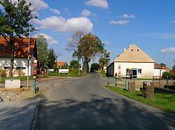
 Common in Nupaky | |
| Coordinates: 49°59′38″N 14°36′8″E / 49.99389°N 14.60222°E | |
| Country | |
| Region | Central Bohemian |
| District | Prague-East |
| First mentioned | 1380 |
| Area | |
• Total | 3.18 km2 (1.23 sq mi) |
| Elevation | 315 m (1,033 ft) |
| Population (2024-01-01)[1] | |
• Total | 2,077 |
| • Density | 650/km2 (1,700/sq mi) |
| Time zone | UTC+1 (CET) |
| • Summer (DST) | UTC+2 (CEST) |
| Postal code | 251 01 |
| Website | www |
Nupaky is a municipality and village in Prague-East District in the Central Bohemian Region of the Czech Republic. It has about 2,100 inhabitants.
Geography
[edit]Nupaky is located about 7 kilometres (4 mi) southeast of Prague. It lies in a flat agricultural landscape in the Prague Plateau.
History
[edit]The first written mention of Nupaky is from 1380. Until the Hussite Wars, part of the village was owned by the Vyšehrad Chapter and part by a local noble. After the wars, it was owned by a family who called themselves the Lords of Nupaky. From 1514, Nupaky was a part of the Koloděje estate. In 1623, Nupaky was confiscated from Václav Štastný Rous of Vražkov as a result of the Battle of White Mountain. From 1623 until the establishment of the independent municipality in 1848, Nupaky belonged to the Uhříněves estate, owned by the Liechtenstein family.[2]
Demographics
[edit]
|
|
| ||||||||||||||||||||||||||||||||||||||||||||||||||||||
| Source: Censuses[3][4] | ||||||||||||||||||||||||||||||||||||||||||||||||||||||||
Economy
[edit]Nupaky is known for its industrial zone, which benefits from the proximity of Prague and the motorways.
Transport
[edit]Nupaky lies at the junction of D0 and D1 motorways.
Sights
[edit]There are no protected cultural monuments in the municipality.[5]
References
[edit]- ^ "Population of Municipalities – 1 January 2024". Czech Statistical Office. 2024-05-17.
- ^ "Historie obce Nupaky" (in Czech). Obec Nupaky. Retrieved 2024-02-11.
- ^ "Historický lexikon obcí České republiky 1869–2011" (in Czech). Czech Statistical Office. 2015-12-21.
- ^ "Population Census 2021: Population by sex". Public Database. Czech Statistical Office. 2021-03-27.
- ^ "Výsledky vyhledávání: Kulturní památky, obec Nupaky". Ústřední seznam kulturních památek (in Czech). National Heritage Institute. Retrieved 2024-08-21.
External links
[edit]


