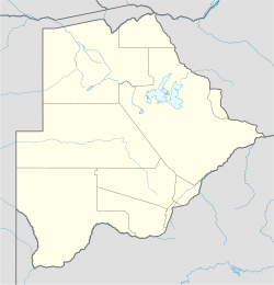
Moshupa
This article's lead section may be too long. (July 2024) |
Moshupa | |
|---|---|
Village | |
| Coordinates: 24°46′45″S 25°25′06″E / 24.77917°S 25.41833°E | |
| Country | Botswana |
| District | Southern District |
| Elevation | 1,141 m (3,743 ft) |
| Population (2011)[1] | |
• Total | 19,780 |
| Time zone | GMT +2 |
| Climate | BSh |
Moshupa is a large village in the Southern District of Botswana with a population of 20,016 per the 2011 census.[2] The people of Moshupa are called the Bakgatla-ba-ga Mmanaana, a group also found in Thamaga. Along with the related Bakgatla-ba-ga Kgafela of Mochudi, they arrived to the region from the Transvaal region in South Africa throughout the eighteenth century.[3]
Moshupa is characterised by unique and gigantic mountain outcrops which often leave visitors in wonder. The giant rocks (some up to 40 metres in radius) are so balanced on top of each other that even the villagers themselves wonder why they do not fall. They are believed to fall only when the village chief is dying, as an omen.[4]
The chief (kgosi) of Moshupa is Kgosi Kgabosetso Mosielele. The chief currently serves in the Customary Court of Appeal and his brother, Kgosi Oscar Mosielele is the current chief of the village on his behalf. As is customary in Botswana the salutation 'kgosi' is the title used before the chiefs name.
Religion
[edit]There are a large number of Christians in Moshupa. The most popular are the United Congregational Church of South Africa, the Seventh-day Adventist Church, the Assemblies of God, the Apostolic Faith Mission, the Roman Catholic Church, the Zion Christian Church, and the Indian Pentecostal Church of God alongside other Afro-Christian and charismatic Pentecostal assemblies. One of the oldest churches is the Mothowagae Church, established in 1903.[5]
Politics
[edit]The member of parliament for Moshupa is the Honorable Karabo Gare. His Excellency Mokgweetsi Keabetswe Eric Masisi, a Moshupa native, is serving in the current cabinet as the President of Botswana. Hon. Masisi is son to the first MP for Moshupa who won the first elections after independence. Hon Mokgweetsi Eric Masisi also had one of his brothers serving as an MP in Francistown West constituency before his passing in 2013. He has received advanced training at graduate level in the fields of education, economics (social policy and social development) and recently began studying epidemiology.[6]
References
[edit]- Comptes Rendus (1954)
- University of London Institute of Commonwealth Studies (1968) Collected Seminar Papers, no.8-13 1967-1971
Line notes
[edit]- ^ "2011 census". Archived from the original on 11 January 2013.
- ^ Molemoeng, Timothy (2020). "2011 Botswana Population Housing and Census". Statistics Botswana. Archived (PDF) from the original on 28 September 2023. Retrieved 28 September 2023.
- ^ Matemba, Yonah Hisbon (2000). "The BaKgatla ba ga Mmanaana split, 1934-36: The impact of the Biritish sub-Imperial rule in Botswana" (PDF). [the Botswana society]. 32 (2000): 44–46. JSTOR 40980265 – via JSTOR.
- ^ "Moshupa". Botswana Info Directory. Retrieved 28 September 2023.
- ^ University of London Institute, 1968
- ^ "Botswana Democratic Party". Archived from the original on 6 July 2011. Retrieved 20 February 2010.

