Morarano Gare
Morarano Gare
Morarano Gara | |
|---|---|
| Coordinates: 18°43′S 48°16′E / 18.71°S 48.27°E | |
| Country | |
| Region | Alaotra-Mangoro |
| District | Moramanga |
| Government | |
| • Mayor | Lala Razanaparany |
| Area | |
• Total | 921.35 km2 (355.74 sq mi) |
| Population (2018) | |
• Total | 17,545 |
| • | Bezanozano (80%) |
| Time zone | UTC3 (EAT) |
| Postal code | 514 |
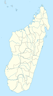
Morarano Gare is a rural municipality in Madagascar. It belongs to the district of Moramanga, which is a part of Alaotra-Mangoro Region. The population of the commune was 17,545 in 2018.
7 fokontany (villages) belong to the municipality that are: Marovoay, Morarano Gare, Ambohidray, Marofody, Androfia, Ambohibolakely and Sakalava.[2]
In the west flows the Mangoro River over 25 km at the limits of the municipality.
Primary and junior level secondary education are available in town. The majority 98% of the population of the commune are farmers. The most important crop is rice, while other important products are cassava and sweet potatoes. Industry and services provide both employment for 1% of the population.[3]
Transport
[edit]The town is situated at 30 km from Moramanga on the RN44 and the railway line Moramanga – Ambatondrazaka (MLA: Moramanga-Lac-Alaotra).
Mining
[edit]The Ambatovy mine, a large nickel and cobalt mine, is partly located in this municipality.
References
[edit]- ^ BITUMAGE de la RN44 Marovoay- Vohidiala
- ^ Ambohibary et de Morarano Gare face au projet minier d’Ambatovy
- ^ "ILO census data". Cornell University. 2002. Retrieved 2008-03-24.


