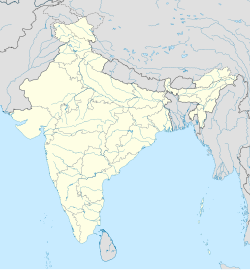
Mohammadpur, Bihar
Appearance
This article relies largely or entirely on a single source. (June 2013) |
Mohammadpur | |
|---|---|
| Coordinates: 26°19′53″N 85°07′07″E / 26.331477°N 85.118654°E | |
| Country | |
| State | Bihar |
| Government | |
| • Body | Panchayati raj |
| Area | |
• Total | 2 km2 (0.8 sq mi) |
| Population | |
• Total | 5,000 |
| • Density | 2,500/km2 (6,000/sq mi) |
| Demonym | Mehsiwashi |
| Languages | |
| • Official | Bhojpuri Hindi |
| Time zone | UTC+5:30 (IST) |
| ISO 3166 code | IN-BR |
| Vehicle registration | BR05 |
| Coastline | 0 kilometres (0 mi) |
Mohammadpur is a panchayat raj and Nearest city Mehsi, Bihar.
The nearest Mehsi railway station, 7.21 km
References
[edit]


