Miskolc Airfield
Appearance
Miskolc Airport Miskolci repülőtér | |||||||||||
|---|---|---|---|---|---|---|---|---|---|---|---|
 Planes during take-off at Miskolc Airport | |||||||||||
| Summary | |||||||||||
| Airport type | Private | ||||||||||
| Operator | Borsod County Flight Club | ||||||||||
| Serves | Miskolc, Borsod-Abaúj-Zemplén County, Hungary | ||||||||||
| Elevation AMSL | 119 m / 390 ft | ||||||||||
| Coordinates | 48°08′16″N 020°47′24″E / 48.13778°N 20.79000°E | ||||||||||
| Website | http://www.lhmc.hu/ (hu) | ||||||||||
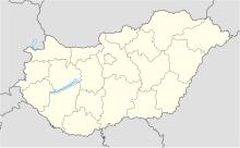
| Map | |||||||||||
 | |||||||||||
| Runways | |||||||||||
| |||||||||||
Miskolc Airfield (Hungarian: Miskolci repülőtér) (IATA: MCQ, ICAO: LHMC) was a small unpaved aerodrome in Miskolc, in the Borsod-Abaúj-Zemplén County of Hungary. It operated regular domestic flights until 1967, then served general aviation (gliding, parachuting, sightseeing) until 2022. Now it is a closed private airport unused.
See also
[edit]External links
[edit]- Airport information
- Operator's official site (Hungarian only)
- History of the airport (Hungarian only)

