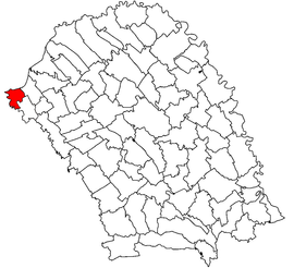
Mihăileni, Botoșani
Appearance
This article needs additional citations for verification. (February 2020) |
Mihăileni | |
|---|---|
 Location in Botoșani County | |
| Coordinates: 47°58′N 26°08′E / 47.967°N 26.133°E | |
| Country | Romania |
| County | Botoșani |
| Subdivisions | Mihăileni, Pârâu Negru, Rogojești |
| Government | |
| • Mayor (2024–2028) | Ioan Laurențiu Barbacariu (PSD) |
Area | 34.62 km2 (13.37 sq mi) |
| Population (2021-12-01)[1] | 2,075 |
| • Density | 60/km2 (160/sq mi) |
| Time zone | EET/EEST (UTC+2/+3) |
| Postal code | 717260 |
| Area code | +40 x31 |
| Vehicle reg. | BT |
Mihăileni is a commune in Botoșani County, Romania. It is composed of three villages: Mihăileni, Pârâu Negru and Rogojești, with a total population of 2,283 as of 2011.
Rogojești and the former village of Sinăuții de Jos (now part of Mihăileni) are located in Bukovina, while the rest of Mihăileni and Pârâu Negru are in Western Moldavia.[citation needed] Mihăileni was established in 1792, subsequent to the opening of a customs checkpoint between Austria and Moldavia.[2]
At the 2011 census, 83.4% of inhabitants were Romanians and 14.3% Ukrainians. At the 2002 census, 89% were Romanian Orthodox and 8.7% Pentecostal.
Natives
[edit]References
[edit]- ^ "Populaţia rezidentă după grupa de vârstă, pe județe și municipii, orașe, comune, la 1 decembrie 2021" (XLS). National Institute of Statistics.
- ^ Research, Yivo Institute for Jewish (2008). The YIVO Encyclopedia of Jews in Eastern Europe. Yale University Press. ISBN 978-0-300-11903-9.


