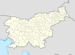
Mestinje
Appearance
Mestinje
Zgornje Mestinje (until 1952) | |
|---|---|
| Coordinates: 46°14′10.43″N 15°33′43.96″E / 46.2362306°N 15.5622111°E | |
| Country | |
| Traditional region | Styria |
| Statistical region | Savinja |
| Municipality | Šmarje pri Jelšah |
| Area | |
• Total | 1.8 km2 (0.7 sq mi) |
| Elevation | 229.5 m (753.0 ft) |
| Population (2002) | |
• Total | 301 |
| [1] | |
Mestinje (pronounced [mɛˈstiːnjɛ]) is a settlement in the Municipality of Šmarje pri Jelšah in eastern Slovenia. The area is part of the historical Styria region. The municipality is now included in the Savinja Statistical Region.[2] It lies on the crossroads with the regional roads towards Rogaška Slatina and Podčetrtek and on the railway line from Grobelno to Rogatec.
Name
[edit]The name of the settlement was changed from Zgornje Mestinje to Mestinje in 1952.[3]
Notable people
[edit]Notable people that were born or lived in Mestinje include:
- Jakob Sket (1852–1912), writer
References
[edit]- ^ Statistical Office of the Republic of Slovenia
- ^ Šmarje pri Jelšah municipal site
- ^ Spremembe naselij 1948–95. 1996. Database. Ljubljana: Geografski inštitut ZRC SAZU, DZS.


