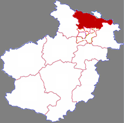
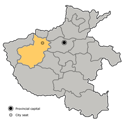
Mengjin, Luoyang
Mengjin
孟津区 Mengtsing | |
|---|---|
 Mengjin in Luoyang | |
 Luoyang in Henan | |
| Coordinates: 34°49′30″N 112°26′42″E / 34.825°N 112.445°E | |
| Country | People's Republic of China |
| Province | Henan |
| Prefecture-level city | Luoyang |
| Area | |
• Total | 759 km2 (293 sq mi) |
| Population (2020)[2] | |
• Total | 486,300 |
| • Density | 640/km2 (1,700/sq mi) |
| Time zone | UTC+8 (China Standard) |
| Postal code | 471100 |
| Mengjin, Luoyang | |||||||||||
|---|---|---|---|---|---|---|---|---|---|---|---|
| Traditional Chinese | 孟津區 | ||||||||||
| Simplified Chinese | 孟津区 | ||||||||||
| Hanyu Pinyin | Mèngjīn Qū | ||||||||||
| |||||||||||
Mengjin District[3] is a district in Luoyang City, in the northwest of Henan province, China, located to the north of Luoyang's urban districts.
History
[edit]Mengjin began its life as an ancient ferry crossing for the Yellow River. According to legend, King Wu of Zhou crossed the Yellow River at this location, after forming an alliance with the other nobles, leading to the theory that the original name was actually (盟津; Méngjīn; 'ferry crossing of the alliance') rather than 孟津; Mèngjīn. According to this theory, it was only in later times that the character 盟 was mistakenly replaced by 孟. The ferry crossing was an important strategic location during times of war.
In Chapter 6 of Romance of the Three Kingdoms, Cao Cao explains that part of his strategy in engaging Dong Zhuo's forces was for Yuan Shao's forces to take control of Mengjin (see: Battle of Xingyang).
As of 2012, Mengjin is divided to 10 towns.[4] In March 2021, Jili District was merged into Mengjin District.[5]
- Towns
|
|
Climate
[edit]| Climate data for Mengjin, elevation 329 m (1,079 ft), (1991–2020 normals, extremes 1981–2010) | |||||||||||||
|---|---|---|---|---|---|---|---|---|---|---|---|---|---|
| Month | Jan | Feb | Mar | Apr | May | Jun | Jul | Aug | Sep | Oct | Nov | Dec | Year |
| Record high °C (°F) | 19.6 (67.3) |
24.5 (76.1) |
32.3 (90.1) |
38.7 (101.7) |
40.2 (104.4) |
40.7 (105.3) |
41.1 (106.0) |
38.6 (101.5) |
37.6 (99.7) |
34.2 (93.6) |
27.0 (80.6) |
22.8 (73.0) |
41.1 (106.0) |
| Mean daily maximum °C (°F) | 5.4 (41.7) |
9.1 (48.4) |
15.0 (59.0) |
21.9 (71.4) |
27.1 (80.8) |
31.3 (88.3) |
31.3 (88.3) |
29.7 (85.5) |
25.8 (78.4) |
20.5 (68.9) |
13.5 (56.3) |
7.5 (45.5) |
19.8 (67.7) |
| Daily mean °C (°F) | 0.5 (32.9) |
3.8 (38.8) |
9.3 (48.7) |
15.8 (60.4) |
21.2 (70.2) |
25.6 (78.1) |
26.6 (79.9) |
25.1 (77.2) |
20.9 (69.6) |
15.4 (59.7) |
8.5 (47.3) |
2.5 (36.5) |
14.6 (58.3) |
| Mean daily minimum °C (°F) | −3.1 (26.4) |
−0.2 (31.6) |
4.8 (40.6) |
10.6 (51.1) |
15.9 (60.6) |
20.6 (69.1) |
22.8 (73.0) |
21.7 (71.1) |
17.0 (62.6) |
11.3 (52.3) |
4.6 (40.3) |
−1.2 (29.8) |
10.4 (50.7) |
| Record low °C (°F) | −14.1 (6.6) |
−13.1 (8.4) |
−8.2 (17.2) |
−0.5 (31.1) |
5.4 (41.7) |
12.3 (54.1) |
15.4 (59.7) |
11.7 (53.1) |
6.5 (43.7) |
−1.5 (29.3) |
−11.7 (10.9) |
−13.5 (7.7) |
−14.1 (6.6) |
| Average precipitation mm (inches) | 9.3 (0.37) |
12.5 (0.49) |
23.0 (0.91) |
40.3 (1.59) |
53.4 (2.10) |
68.6 (2.70) |
123.4 (4.86) |
100.4 (3.95) |
88.9 (3.50) |
43.3 (1.70) |
27.0 (1.06) |
6.3 (0.25) |
596.4 (23.48) |
| Average precipitation days (≥ 0.1 mm) | 3.8 | 4.3 | 5.7 | 6.1 | 7.3 | 7.8 | 10.9 | 10.3 | 9.2 | 6.9 | 5.5 | 3.2 | 81 |
| Average snowy days | 4.3 | 4.0 | 1.9 | 0.2 | 0 | 0 | 0 | 0 | 0 | 0 | 1.5 | 3.0 | 14.9 |
| Average relative humidity (%) | 53 | 54 | 54 | 56 | 57 | 59 | 75 | 78 | 72 | 64 | 60 | 53 | 61 |
| Mean monthly sunshine hours | 142.3 | 144.6 | 182.1 | 213.0 | 227.9 | 206.8 | 177.3 | 177.7 | 159.9 | 162.3 | 153.3 | 158.4 | 2,105.6 |
| Percent possible sunshine | 45 | 46 | 49 | 54 | 52 | 48 | 41 | 43 | 43 | 47 | 50 | 52 | 48 |
| Source: China Meteorological Administration[6][7] | |||||||||||||
See also
[edit]References
[edit]- ^ 最新人口信息 www.hongheiku.com (in Chinese). hongheiku. Retrieved 2021-01-12.
- ^ 最新人口信息 www.hongheiku.com (in Chinese). hongheiku. Retrieved 2021-01-12.
- ^ "国务院同意河南省洛阳市调整部分行政区划". 2021-03-18.
- ^ 洛阳市-行政区划网 www.xzqh.org (in Chinese). XZQH. Retrieved 2012-05-24.
- ^ "国务院同意河南省洛阳市调整部分行政区划_河南要闻_河南省人民政府门户网站". www.henan.gov.cn. Retrieved 2024-08-25.
- ^ 中国气象数据网 – WeatherBk Data (in Simplified Chinese). China Meteorological Administration. Retrieved 12 August 2023.
- ^ 中国气象数据网 (in Simplified Chinese). China Meteorological Administration. Retrieved 12 August 2023.
- Hanyu Da Cidian 3.0 (in Chinese). Hong Kong: Commercial Press. 2007. ISBN 978-962-07-0277-8.
