Maleme Airport
Appearance
This article includes a list of general references, but it lacks sufficient corresponding inline citations. (October 2014) |
Maleme Airport Αεροδρόμιο Μάλεμε | |||||||||||||||
|---|---|---|---|---|---|---|---|---|---|---|---|---|---|---|---|
| Summary | |||||||||||||||
| Airport type | Public | ||||||||||||||
| Serves | Chania | ||||||||||||||
| Location | Maleme | ||||||||||||||
| Elevation AMSL | 16 ft / 5 m | ||||||||||||||
| Coordinates | 35°31′45.70″N 23°49′56.23″E / 35.5293611°N 23.8322861°E | ||||||||||||||
| Map | |||||||||||||||
 | |||||||||||||||
| Runways | |||||||||||||||
| |||||||||||||||
Source:Airliners.gr Maleme | |||||||||||||||
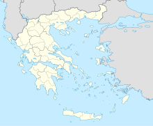
Maleme Airport (Greek: Αεροδρόμιο Μάλεμε) is an airport situated between Maleme and Tavronitis, Crete. It has two runways (13/31 and 03/21) with no lights. The airport has closed for commercial aviation, but the Chania Aeroclub continues to use it. The airport operated until 1959 as the main public airport of Chania. Up until 2012 the Hellenic Air Force made limited use of the facility. [1]
Originally known as Maleme Airfield, it was an RAF base in World War II until captured by German parachutists and mountain troops landing there in May 1941 as part of the Battle of Crete.[2]

See also
[edit]References
[edit]- ^ "Do you know that there are six airfields in Crete?". TheNewCrete. 22 December 2024.
- ^ Biank, Major Maria A. (2014-08-15). Battle Of Crete: Hitler's Airborne Gamble. Pickle Partners Publishing. ISBN 978-1-78289-321-9.
External links
[edit]- Maleme at Battlefield Review
- Maleme at Forgotten Airfields
- The Battle of Maleme at Hellenic Foundation

